MyTopo
Scipio Oklahoma US Topo Map
Couldn't load pickup availability
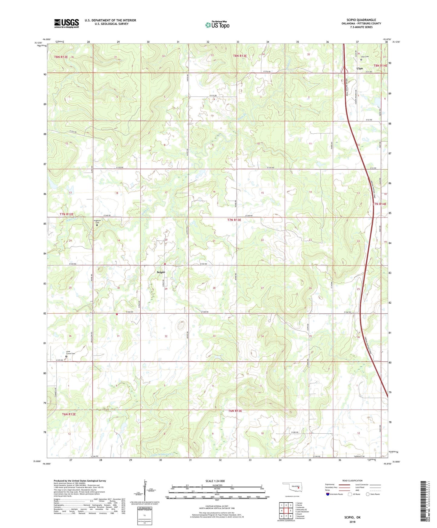
2022 topographic map quadrangle Scipio in the state of Oklahoma. Scale: 1:24000. Based on the newly updated USGS 7.5' US Topo map series, this map is in the following counties: Pittsburg. The map contains contour data, water features, and other items you are used to seeing on USGS maps, but also has updated roads and other features. This is the next generation of topographic maps. Printed on high-quality waterproof paper with UV fade-resistant inks.
Quads adjacent to this one:
West: Wetumka SE
Northwest: Carson
North: Hanna
Northeast: Indianola
East: Lake McAlester
Southeast: McAlester
South: Haywood
Southwest: Stuart
This map covers the same area as the classic USGS quad with code o35095a8.
Contains the following named places: Hughlow Cemetery, Lone Grove Cemetery, Lone Grove Church, Scipio, Scipio Census Designated Place, Tannehill Volunteer Fire Department Substation 3, Tannehill Volunteer Fire Department Substation 4, Ulan, Ulan Cemetery