MyTopo
McAlester SW Oklahoma US Topo Map
Couldn't load pickup availability
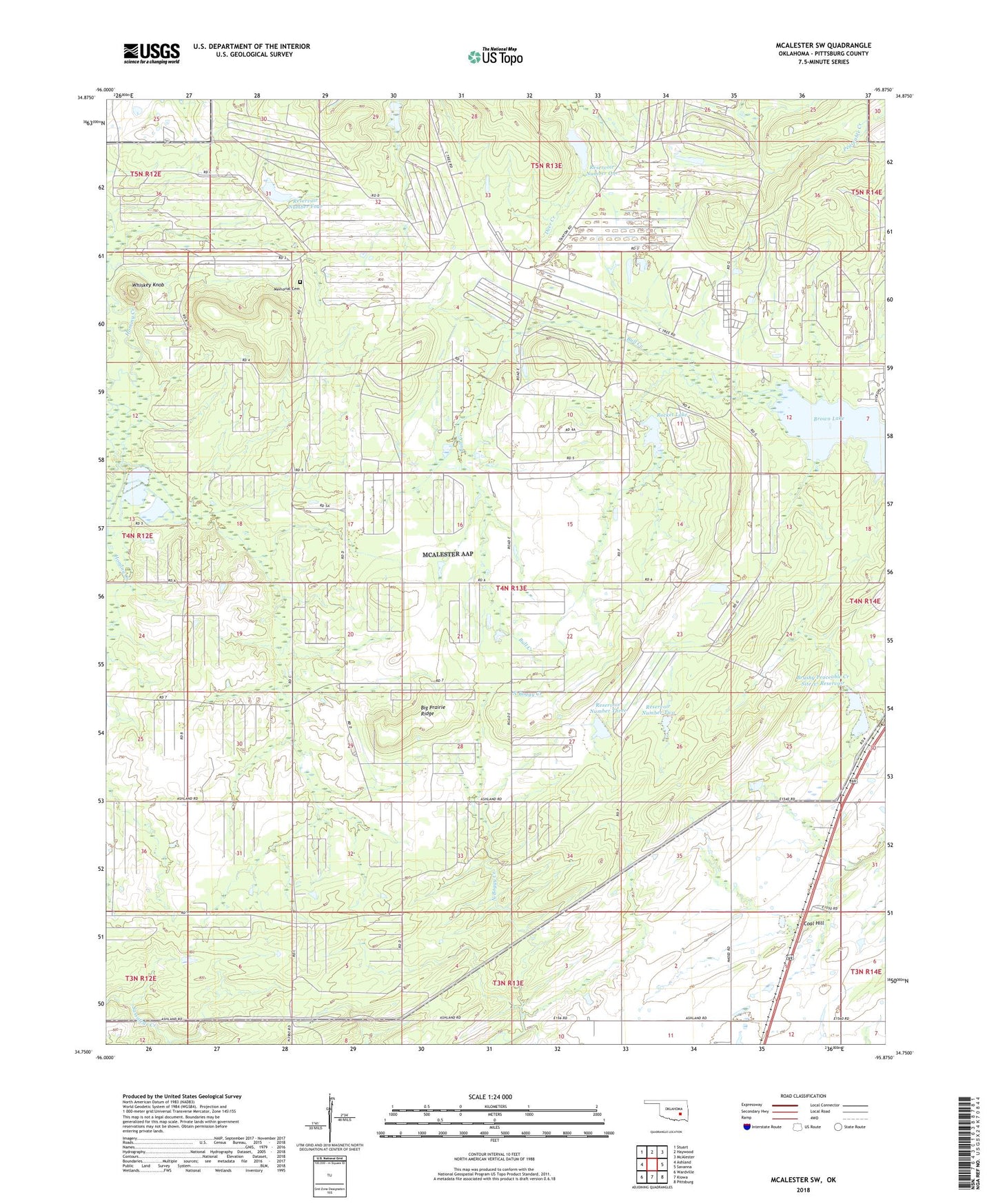
2022 topographic map quadrangle McAlester SW in the state of Oklahoma. Scale: 1:24000. Based on the newly updated USGS 7.5' US Topo map series, this map is in the following counties: Pittsburg. The map contains contour data, water features, and other items you are used to seeing on USGS maps, but also has updated roads and other features. This is the next generation of topographic maps. Printed on high-quality waterproof paper with UV fade-resistant inks.
Quads adjacent to this one:
West: Ashland
Northwest: Stuart
North: Haywood
Northeast: McAlester
East: Savanna
Southeast: Pittsburg
South: Kiowa
Southwest: Wardville
This map covers the same area as the classic USGS quad with code o34095g8.
Contains the following named places: Big Prairie Ridge, Brown Lake, Brushy Peaceable Creek Site 37 Reservoir, Burshy Peaceable Creek Site 37 Dam, Coal Hill, Dr Number 1 Dam, Dr Number 2 Dam, Dr Number 3 Dam, Dr Number 4 Dam, McAlester Army Ammunition Plant, Memorial Cemetery, Reservoir Number Four, Reservoir Number One, Reservoir Number Three, Reservoir Number Two, Rocket Lake, Rocket Lake Dam, Whiskey Knob