MyTopo
Hontubby Oklahoma US Topo Map
Couldn't load pickup availability
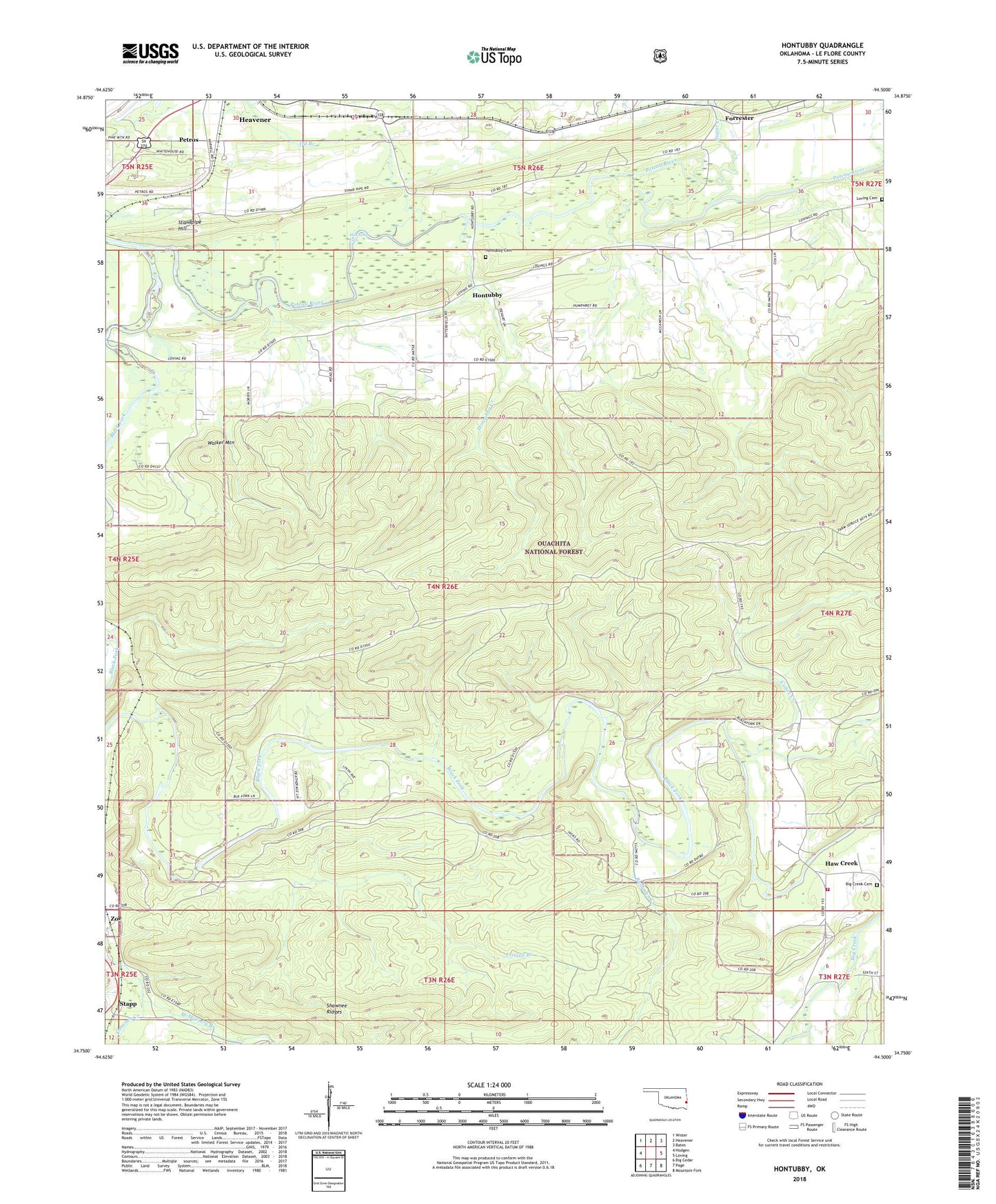
2018 topographic map quadrangle Hontubby in the state of Oklahoma. Scale: 1:24000. Based on the newly updated USGS 7.5' US Topo map series, this map is in the following counties: Le Flore. The map contains contour data, water features, and other items you are used to seeing on USGS maps, but also has updated roads and other features. This is the next generation of topographic maps. Printed on high-quality waterproof paper with UV fade-resistant inks.
Quads adjacent to this one:
West: Hodgen
Northwest: Wister
North: Heavener
Northeast: Bates
East: Loving
Southeast: Mountain Fork
South: Page
Southwest: Big Cedar
Contains the following named places: Big Creek Cemetery, Big Creek Church, Black Fork, Bushman Creek, Cedar Creek, Forrester, Frizzell Branch, Haw Creek, Haw Creek Rural Fire Department, Heavener, Hontubby, Hontubby Cemetery, Hontubby Creek, Hontubby Falls, Jesus Name Church, Loving Cemetery, McMurtery Branch, Oil Branch, Petros, Standpipe Hill, Stapp, Sugar Creek, ZIP Code: 74937