MyTopo
Heavener Oklahoma US Topo Map
Couldn't load pickup availability
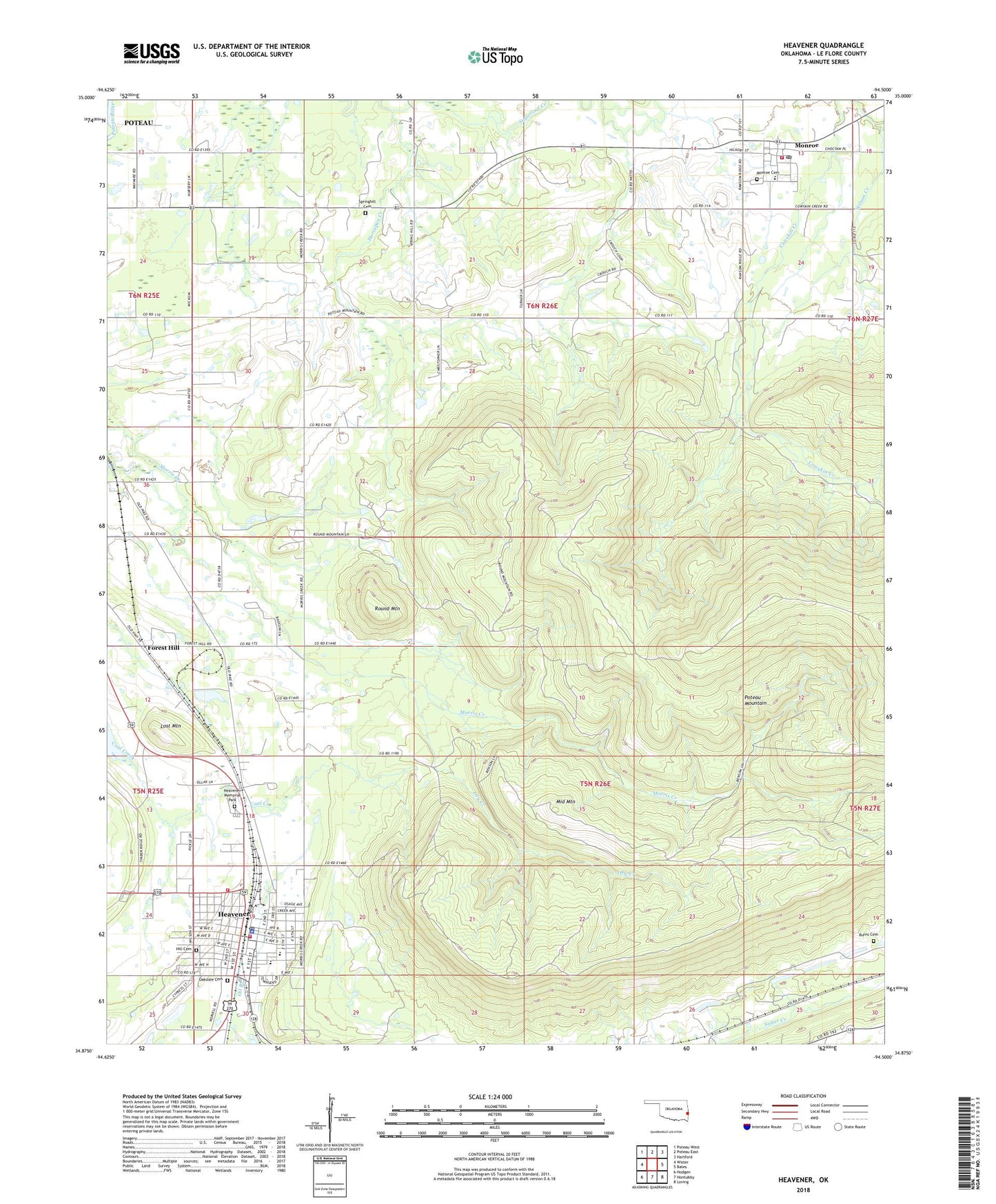
2022 topographic map quadrangle Heavener in the state of Oklahoma. Scale: 1:24000. Based on the newly updated USGS 7.5' US Topo map series, this map is in the following counties: Le Flore. The map contains contour data, water features, and other items you are used to seeing on USGS maps, but also has updated roads and other features. This is the next generation of topographic maps. Printed on high-quality waterproof paper with UV fade-resistant inks.
Quads adjacent to this one:
West: Wister
Northwest: Poteau West
North: Poteau East
Northeast: Hartford
East: Bates
Southeast: Loving
South: Hontubby
Southwest: Hodgen
This map covers the same area as the classic USGS quad with code o34094h5.
Contains the following named places: Assembly of God Church, Burns Cemetery, Church of Christ, City of Heavener, Community Church, Dry Creek, Emergency Medical Services of Le Flore County Station 8 Heavener, First Baptist Church, First United Methodist Church, Forest Hill, Forrester, Free Will Baptist Church, Heavener, Heavener Church of Nazarene, Heavener Elementary School, Heavener Fire Department Eastside Station, Heavener Fire Department West Side Station, Heavener High School, Heavener Memorial Park, Heavener Police Department, Heavener Post Office, Hill Cemetery, Horsepen Creek, KPRV-FM (Heavener), Lost Mountain, Middle Mountain, Monroe, Monroe Cemetery, Monroe Census Designated Place, Monroe Elementary School, Monroe Post Office, Monroe Volunteer Fire Department, Municipal Airport, Oakdale Cemetery, Poteau Mountain, Round Mountain, Runestone State Park, Springhill Cemetery, Springhill Church, Township of Heavener, Township of Monroe, Trinity Baptist Church, Westside School, Wilson Creek, ZIP Code: 74940