MyTopo
Lehigh Oklahoma US Topo Map
Couldn't load pickup availability
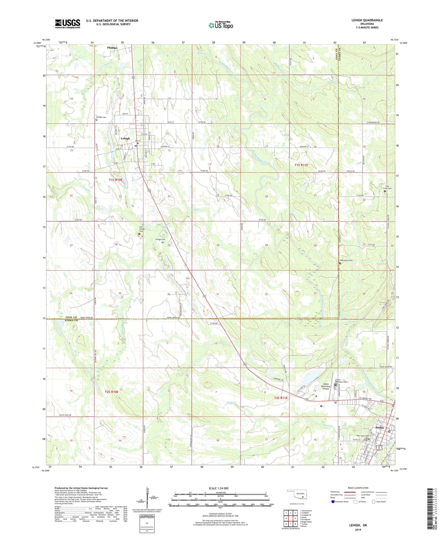
2019 topographic map quadrangle Lehigh in the state of Oklahoma. Scale: 1:24000. Based on the newly updated USGS 7.5' US Topo map series, this map is in the following counties: Coal, Atoka. The map contains contour data, water features, and other items you are used to seeing on USGS maps, but also has updated roads and other features. This is the next generation of topographic maps. Printed on high-quality waterproof paper with UV fade-resistant inks.
Quads adjacent to this one:
West: Olney
Northwest: Centrahoma
North: Coalgate
Northeast: Coalgate SE
East: Stringtown
Southeast: Bruno
South: Tushka
Southwest: Boggy Depot
Contains the following named places: Atoka, Atoka County Jail, Atoka County Medical Center, Atoka County Sheriff's Office, Atoka Elementary School, Atoka High School, Atoka Lake, Atoka Lake Dam, Atoka Middle School, Atoka Municipal Airport, Atoka Police Department, Brier Creek, City of Atoka, City of Lehigh, Coal Creek, Coal Creek Cemetery, Coal Creek Church, Dunford Creek, Faith Christian School, Fist Baptist Church, French Henry Creek, Green Meadows Cemetery, Hickory Hill Strip Mine, KEOR-AM (Atoka), KHKC-FM (Atoka), Kiamichi Technology Center Atoka Campus, Lehigh, Lehigh Cemetery, Lehigh Fire Department, Lehigh Post Office, Lehigh Strip Mine, Long Creek, Macedonia Cemetery, Macedonia Church, Macedonia School, McCall Middle School, Midway, Old Lehigh Cemetery, Presbyterian Church, Sand Creek, Sandy Creek, Thunderbird School, West View Cemetery, ZIP Code: 74556