MyTopo
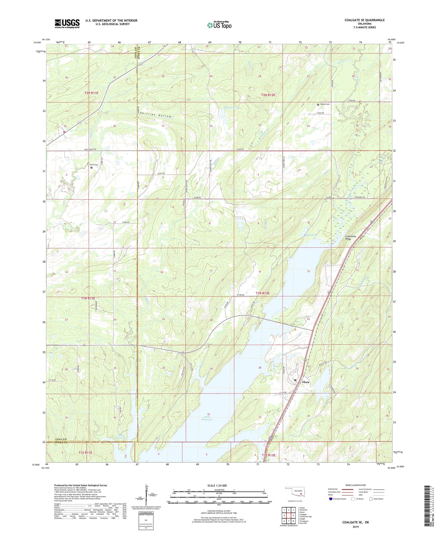
Coalgate SE Oklahoma US Topo Map
Couldn't load pickup availability
2022 topographic map quadrangle Coalgate SE in the state of Oklahoma. Scale: 1:24000. Based on the newly updated USGS 7.5' US Topo map series, this map is in the following counties: Atoka, Coal. The map contains contour data, water features, and other items you are used to seeing on USGS maps, but also has updated roads and other features. This is the next generation of topographic maps. Printed on high-quality waterproof paper with UV fade-resistant inks.
Quads adjacent to this one:
West: Coalgate
Northwest: Parker
North: Wardville
Northeast: Kiowa
East: Limestone Gap
Southeast: Lane NW
South: Stringtown
Southwest: Lehigh
This map covers the same area as the classic USGS quad with code o34096e1.
Contains the following named places: Atoka State Game Refuge, Beck Creek, Bethany Church, Bethel Cemetery, Bluestem Lake, Bluestem Lake Dam, Buck Creek, Cairo Cemetery, Cairo Volunteer Fire Department, Chilly Creek, Elm Creek, Flora, Mack Alford Correctional Center, McEntire Lake, Mcentire Lake Dam, Phillips Hollow, Roberts Creek, Sub-Penitentiary Lake, Troly Lake, Troly Lake Dam