MyTopo
Stringtown Oklahoma US Topo Map
Couldn't load pickup availability
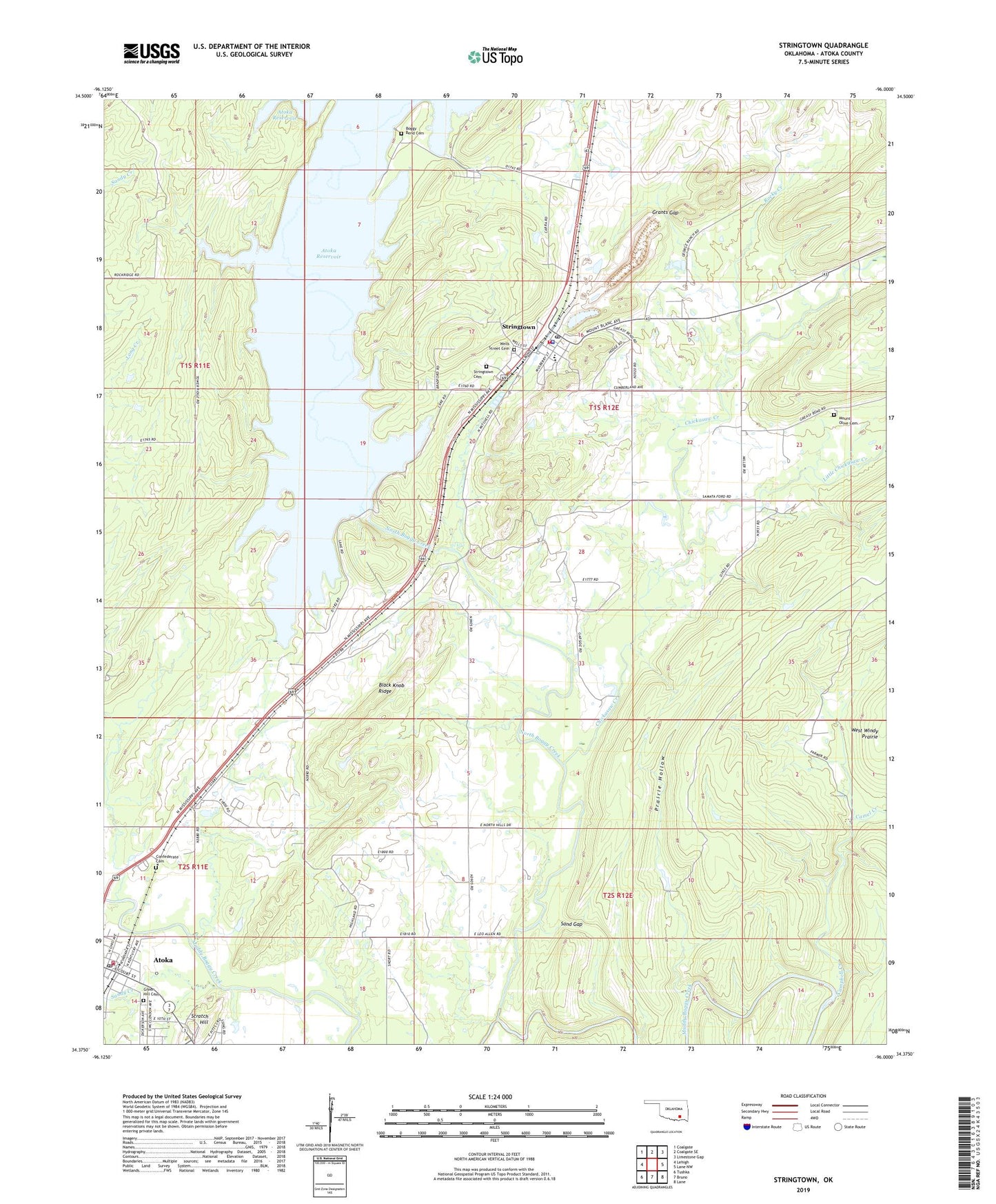
2022 topographic map quadrangle Stringtown in the state of Oklahoma. Scale: 1:24000. Based on the newly updated USGS 7.5' US Topo map series, this map is in the following counties: Atoka. The map contains contour data, water features, and other items you are used to seeing on USGS maps, but also has updated roads and other features. This is the next generation of topographic maps. Printed on high-quality waterproof paper with UV fade-resistant inks.
Quads adjacent to this one:
West: Lehigh
Northwest: Coalgate
North: Coalgate SE
Northeast: Limestone Gap
East: Lane NW
Southeast: Lane
South: Bruno
Southwest: Tushka
This map covers the same area as the classic USGS quad with code o34096d1.
Contains the following named places: Atoka Fire Department Station 1, Atoka Post Office, Atoka Reservoir, Atoka Reservoir Dam, Black Knob Ridge, Boggy Bend Cemetery, Boggy Bend Ford, Boggy Bend School, Camel Creek, Campbell Creek, Chickasaw Creek, Confederate Cemetery, County District 10, Grants Gap, Green Hill Cemetery, Katy Lake, Little Chickasaw Creek, McKinney Cemetery, Mill Creek, Mount Olive Cemetery, Mount Olive Church, North Boggy Creek, Prairie Hollow, Rocky Creek, Sand Gap, Sandy Creek, Stringtown, Stringtown Cemetery, Stringtown Elementary School, Stringtown Fire Department, Stringtown High School, Stringtown Police Department, Stringtown Post Office, Town of Stringtown, Township of Stringtown, Wells Street Cemetery, West Tellico School, West Windy Prairie