MyTopo
Leon North Oklahoma US Topo Map
Couldn't load pickup availability
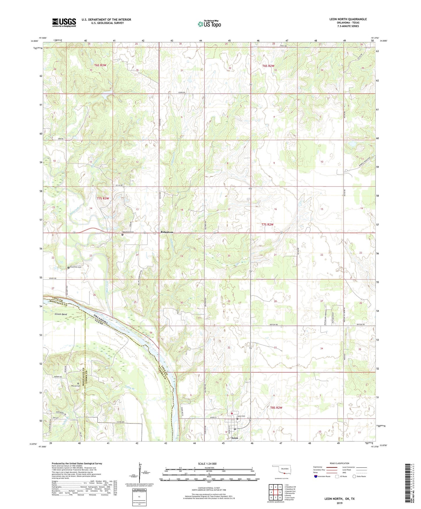
2019 topographic map quadrangle Leon North in the states of Oklahoma, Texas. Scale: 1:24000. Based on the newly updated USGS 7.5' US Topo map series, this map is in the following counties: Love, Cooke, Montague. The map contains contour data, water features, and other items you are used to seeing on USGS maps, but also has updated roads and other features. This is the next generation of topographic maps. Printed on high-quality waterproof paper with UV fade-resistant inks.
Quads adjacent to this one:
West: Spanish Fort
Northwest: Orr
North: Healdton SW
Northeast: Healdton SE
East: Burneyville
Southeast: Marysville
South: Leon South
Southwest: Bonita
Contains the following named places: Coffeepot Creek, Courtney Cemetery, Illinois Bend, James Dula Pond 6, James Dula Pond 6 Dam, Leon, Leon Cemetery, Leon Fire Department, Leon Post Office, Mud Creek, Murrell Cemetery, Red Oak Creek, Rubottom, Rubottom Cemetery, Town of Leon, Valley Branch, West Love Division, ZIP Code: 73441