MyTopo
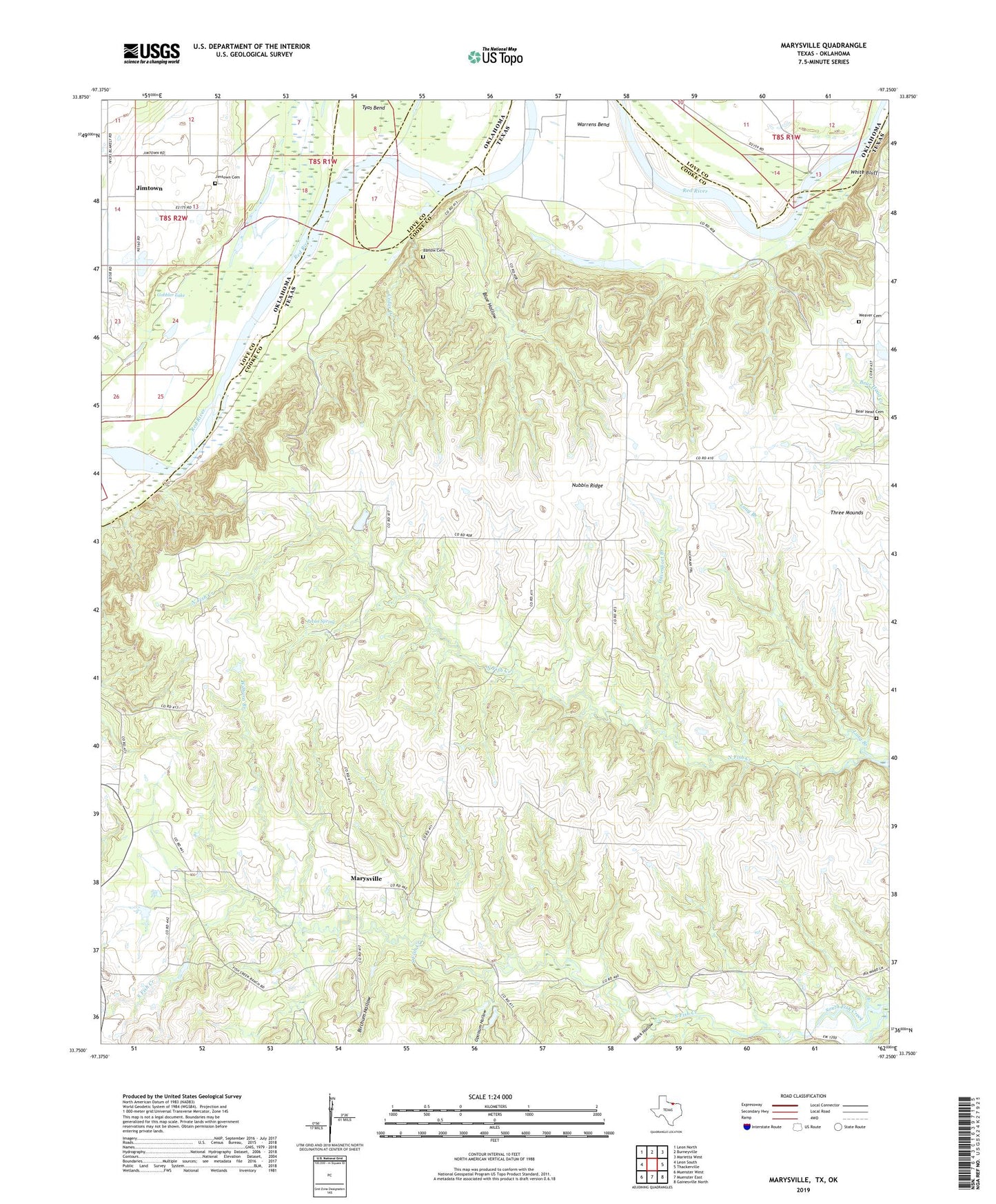
Marysville Texas US Topo Map
Couldn't load pickup availability
2022 topographic map quadrangle Marysville in the states of Texas, Oklahoma. Scale: 1:24000. Based on the newly updated USGS 7.5' US Topo map series, this map is in the following counties: Cooke, Love. The map contains contour data, water features, and other items you are used to seeing on USGS maps, but also has updated roads and other features. This is the next generation of topographic maps. Printed on high-quality waterproof paper with UV fade-resistant inks.
Quads adjacent to this one:
West: Leon South
Northwest: Leon North
North: Burneyville
Northeast: Marietta West
East: Thackerville
Southeast: Gainesville North
South: Muenster East
Southwest: Muenster West
This map covers the same area as the classic USGS quad with code o33097g3.
Contains the following named places: Barlow Cemetery, Bear Head Cemetery, Birchum Hollow, Black Hollow, Blue Hollow, Cedar Creek, Davenport Branch, Gobbler Lake, Jimtown, Jimtown Cemetery, Landers Branch, Long Branch, Marysville, Nubbin Ridge, Opossum Hollow, Pecan Spring, Three Mounds, Tyas Bend, Valley Creek, Warrens Bend, Weaver Cemetery, White Bluff, Wilburn Branch