MyTopo
Lookout Oklahoma US Topo Map
Couldn't load pickup availability
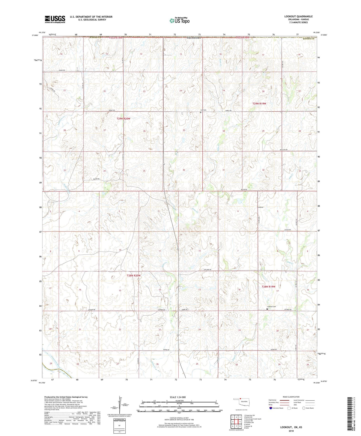
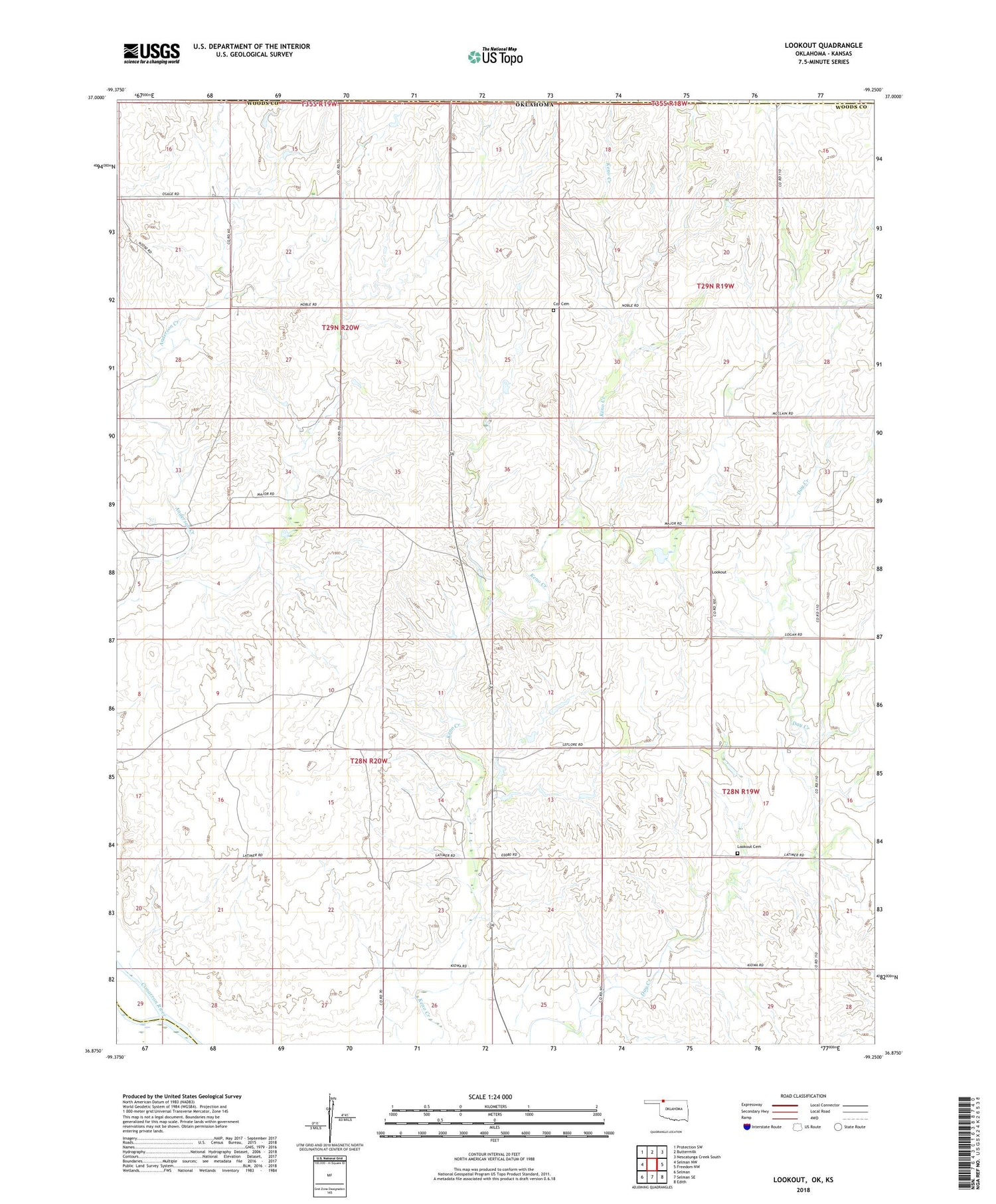
2018 topographic map quadrangle Lookout in the state of Oklahoma. Scale: 1:24000. Based on the newly updated USGS 7.5' US Topo map series, this map is in the following counties: Woods, Harper, Comanche. The map contains contour data, water features, and other items you are used to seeing on USGS maps, but also has updated roads and other features. This is the next generation of topographic maps. Printed on high-quality waterproof paper with UV fade-resistant inks.
Quads adjacent to this one:
West: Selman NW
Northwest: Protection SW
North: Buttermilk
Northeast: Nescatunga Creek South
East: Freedom NW
Southeast: Edith
South: Selman SE
Southwest: Selman
Contains the following named places: Coy Cemetery, Coy Community Hall, Lookout, Lookout Cemetery, Lookout Church, Lookout Community Hall, Schroeder 1a Dam, Schroeder 1a Reservoir, Township of Patterson