MyTopo
Selman NW Oklahoma US Topo Map
Couldn't load pickup availability
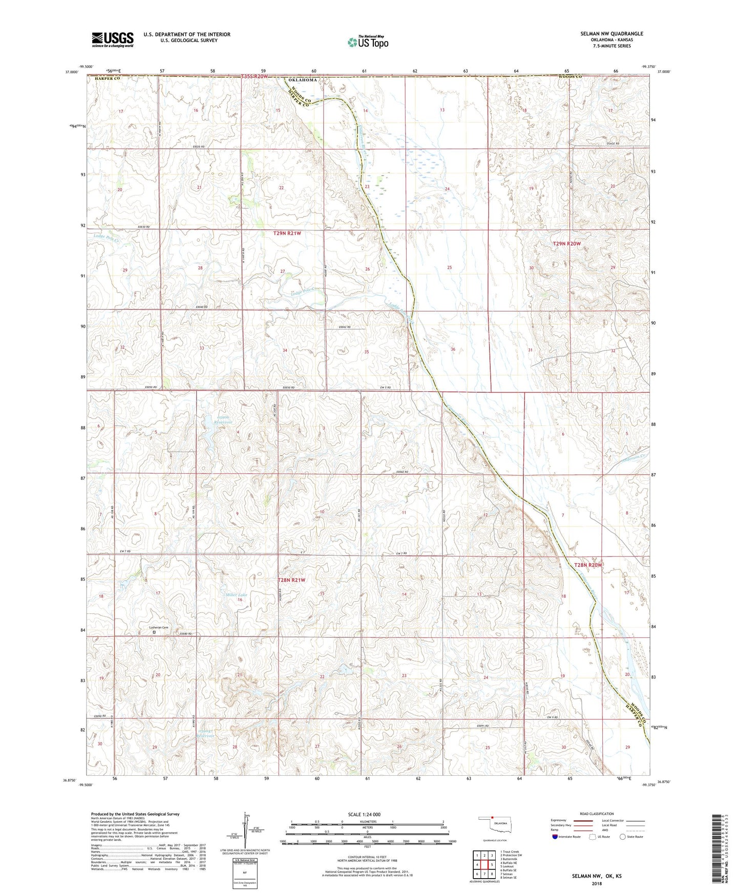
2022 topographic map quadrangle Selman NW in the state of Oklahoma. Scale: 1:24000. Based on the newly updated USGS 7.5' US Topo map series, this map is in the following counties: Harper, Woods, Comanche. The map contains contour data, water features, and other items you are used to seeing on USGS maps, but also has updated roads and other features. This is the next generation of topographic maps. Printed on high-quality waterproof paper with UV fade-resistant inks.
Quads adjacent to this one:
West: Buffalo NE
Northwest: Trout Creek
North: Protection SW
Northeast: Buttermilk
East: Lookout
Southeast: Selman SE
South: Selman
Southwest: Buffalo SE
This map covers the same area as the classic USGS quad with code o36099h4.
Contains the following named places: Anderson Creek, Lodge Pole Creek, Miller Lake, Miller Lake Dam, Oknoname 059046 Dam, Oknoname 059046 Reservoir, Oknoname 059047 Dam, Oknoname 059047 Reservoir, Oknoname 05906 Dam, Oknoname 05906 Reservoir, Oknoname 05908 Dam, Oknoname 05908 Reservoir, Zion Lutheran Cemetery