MyTopo
Madge Oklahoma US Topo Map
Couldn't load pickup availability
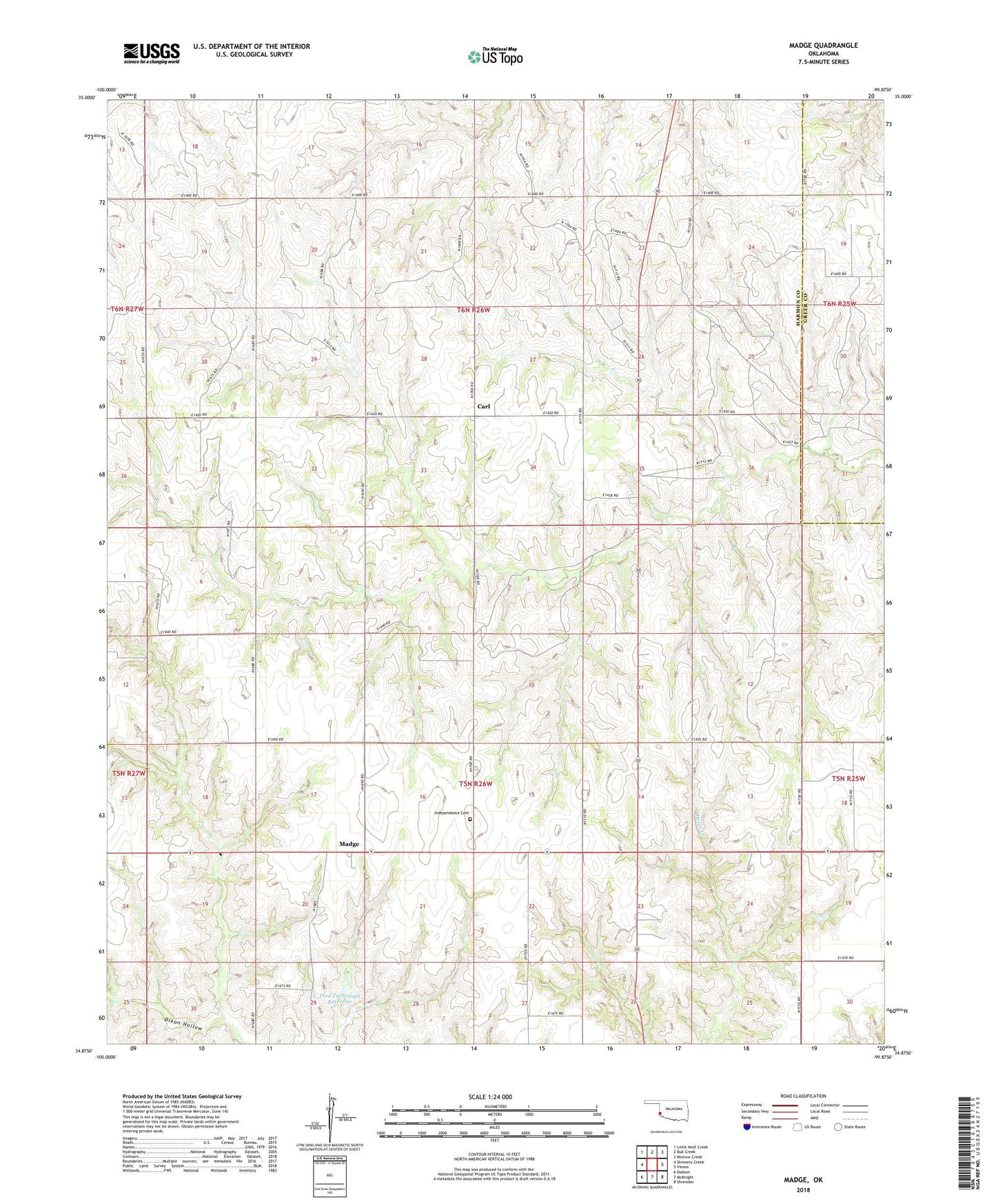
2022 topographic map quadrangle Madge in the state of Oklahoma. Scale: 1:24000. Based on the newly updated USGS 7.5' US Topo map series, this map is in the following counties: Harmon, Greer. The map contains contour data, water features, and other items you are used to seeing on USGS maps, but also has updated roads and other features. This is the next generation of topographic maps. Printed on high-quality waterproof paper with UV fade-resistant inks.
Quads adjacent to this one:
West: Shinnery Creek
Northwest: Little Wolf Creek
North: Bull Creek
Northeast: Minnow Creek
East: Vinson
Southeast: Shrewder
South: McKnight
Southwest: Dodson
Contains the following named places: Carl, Dixon Hollow, Floyd Carter Dam, Floyd Carter Reservoir, Fred Yarbrough Dam, Fred Yarbrough Reservoir, Independence Cemetery, Jolly Bob Downs Dam, Jolly Bob Downs Reservoir, Madge, Rufus Sherrill Number 1 Dam, Rufus Sherrill Number 1 Lake, Rufus Sherrill Number 2 Dam, Rufus Sherrill Number 2 Lake, Township of Madge, ZIP Code: 73571