MyTopo
Nowata West Oklahoma US Topo Map
Couldn't load pickup availability
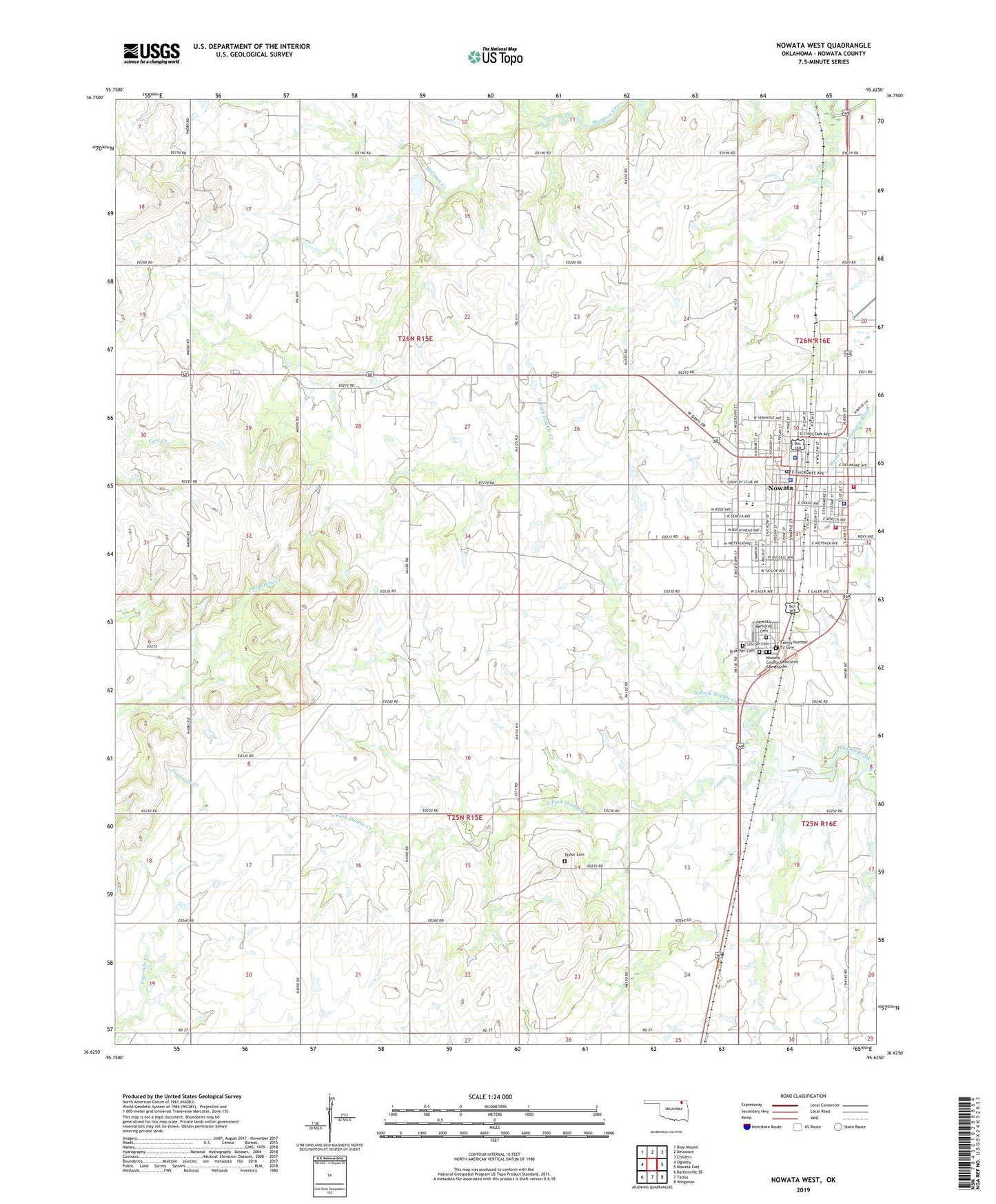
2019 topographic map quadrangle Nowata West in the state of Oklahoma. Scale: 1:24000. Based on the newly updated USGS 7.5' US Topo map series, this map is in the following counties: Nowata. The map contains contour data, water features, and other items you are used to seeing on USGS maps, but also has updated roads and other features. This is the next generation of topographic maps. Printed on high-quality waterproof paper with UV fade-resistant inks.
Quads adjacent to this one:
West: Oglesby
Northwest: Blue Mound
North: Delaware
Northeast: Childers
East: Nowata East
Southeast: Winganon
South: Talala
Southwest: Bartlesville SE
Contains the following named places: Armstrong - Journeycake Cemetery, Bratcher Cemetery, Central Church of Christ, City of Nowata, Diamond Point Community Hall, Elm Bend Community Hall, Family Number 12 Cemetery, Family Number 13 Cemetery, First Baptist Church, First Christian Church, First Church of God, Glenn C. Moore Elementary School, Hillside Church, Jane Phillips Nowata Health Center, Kingdom Hall of Jehovahs Witness, KNFB-FM (Nowata), Lincoln Cemetery, Living Word Family Church, New Life Assembly of God, North Fork Double Creek, Nowata, Nowata County Jail, Nowata County Relocated Cemeteries, Nowata County Sheriff's Office, Nowata Division, Nowata Emergency Medical Services, Nowata Fire Department, Nowata Fire Department Station 2, Nowata High School, Nowata Memorial Cemetery, Nowata Middle School, Nowata Police Department, Nowata Post Office, Presbyterian Church, Saint Catherines Catholic Church, South Fork Double Creek, Taylor Cemetery, Township of Nowata, Township of Watova, Trinity Full Gospel Church, United Methodist Church, ZIP Code: 74048