MyTopo
Talala Oklahoma US Topo Map
Couldn't load pickup availability
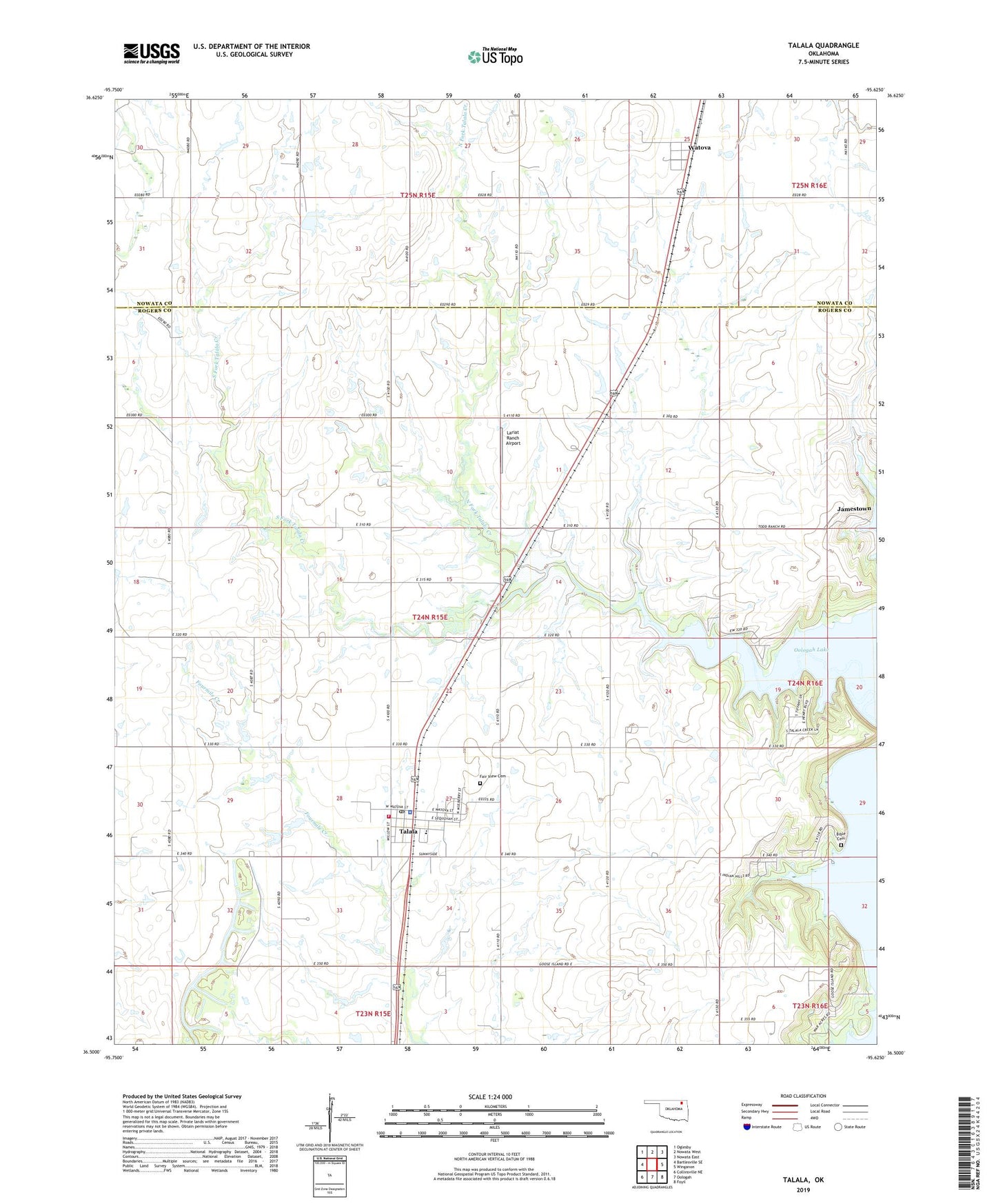
2022 topographic map quadrangle Talala in the state of Oklahoma. Scale: 1:24000. Based on the newly updated USGS 7.5' US Topo map series, this map is in the following counties: Rogers, Nowata. The map contains contour data, water features, and other items you are used to seeing on USGS maps, but also has updated roads and other features. This is the next generation of topographic maps. Printed on high-quality waterproof paper with UV fade-resistant inks.
Quads adjacent to this one:
West: Bartlesville SE
Northwest: Oglesby
North: Nowata West
Northeast: Nowata East
East: Winganon
Southeast: Foyil
South: Oologah
Southwest: Collinsville NE
This map covers the same area as the classic USGS quad with code o36095e6.
Contains the following named places: Bible Cemetery, Fair View Cemetery, Jamestown, KQLL-FM (Owasso), Lariat Ranch Airport, North Fork Talala Creek, Northwest Rogers County Fire Protection District Station 2, Oknoname 131011 Dam, Oknoname 131011 Reservoir, Oknoname Number 105001 Reservoir, Oknoname Number 10501 Dam, South Fork Talala Creek, Talala, Talala Christian Academy, Talala Police Department, Talala Post Office, Town of Jamestown, Town of Talala, Township of Talala, Watova, Watova Census Designated Place, ZIP Code: 74080