MyTopo
Oglesby Oklahoma US Topo Map
Couldn't load pickup availability
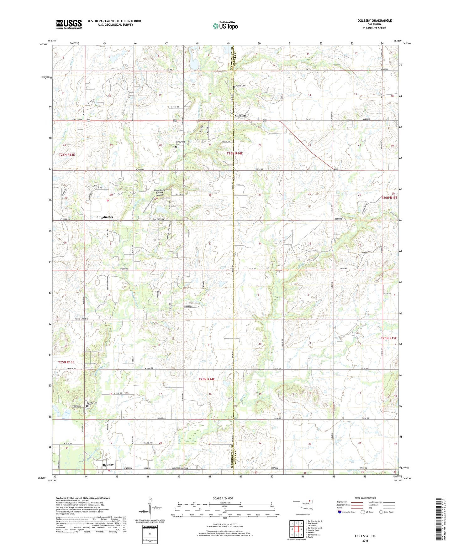
2018 topographic map quadrangle Oglesby in the state of Oklahoma. Scale: 1:24000. Based on the newly updated USGS 7.5' US Topo map series, this map is in the following counties: Nowata, Washington. The map contains contour data, water features, and other items you are used to seeing on USGS maps, but also has updated roads and other features. This is the next generation of topographic maps. Printed on high-quality waterproof paper with UV fade-resistant inks.
Quads adjacent to this one:
West: Bartlesville South
Northwest: Bartlesville North
North: Blue Mound
Northeast: Delaware
East: Nowata West
Southeast: Talala
South: Bartlesville SE
Southwest: Ramona
Contains the following named places: Curleyhead Cemetery, Flying Eagle Estates Airport, Glenoak, Hogshooter, KNFB-FM (Nowata), KYFM-FM (Bartlesville), Oglesby, Oglesby Cemetery, Oglesby Civil Defense Station 2, Oglesby Civil Defense Volunteer Fire Department Station 1, Orville Guinn Number 1 Dam, Orville Guinn Number 1 Reservoir, Purgatory Creek, Willey Cemetery, Willis Jardot Dam, Willis Jardot Reservoir