MyTopo
Ramona Oklahoma US Topo Map
Couldn't load pickup availability
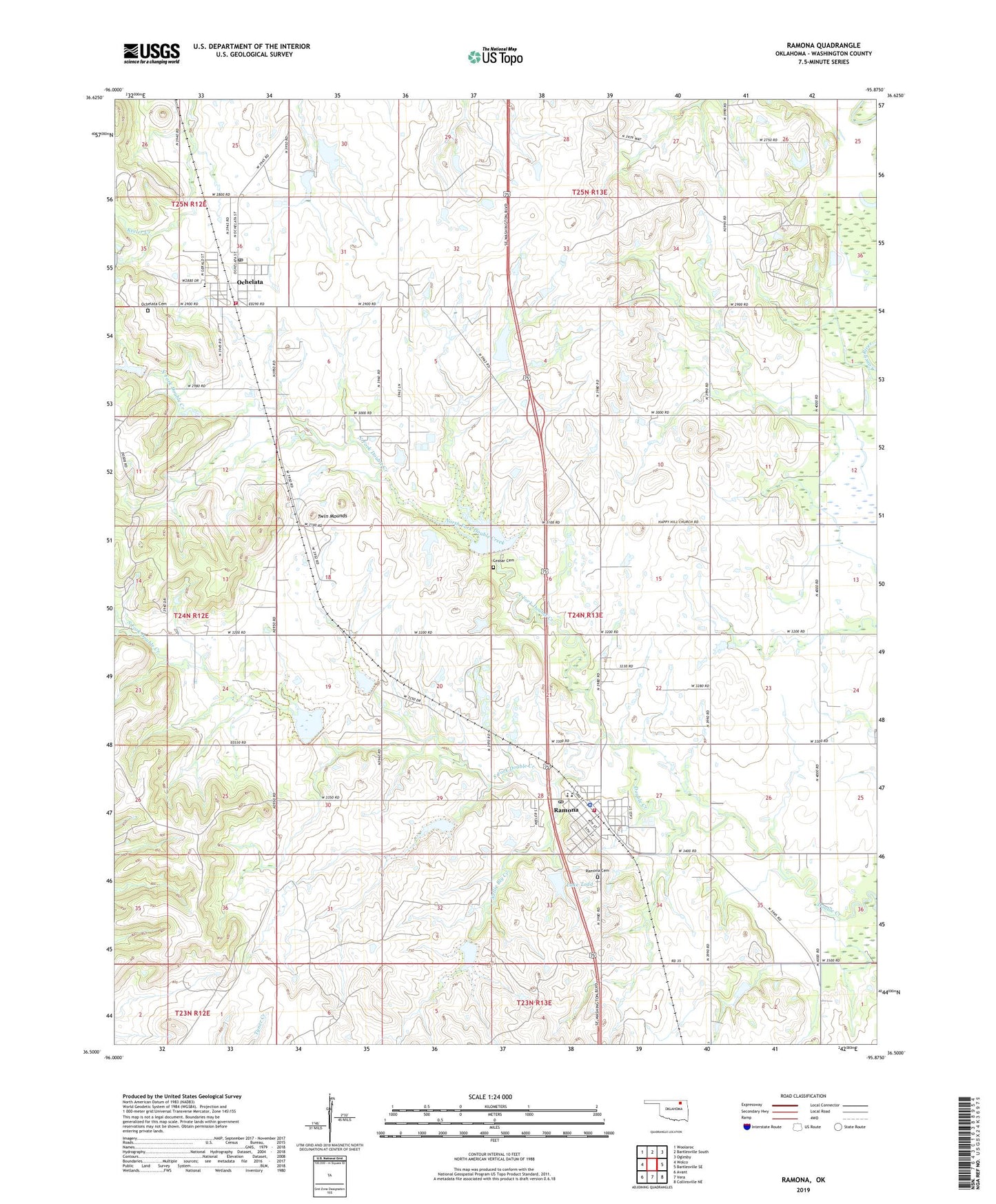
2022 topographic map quadrangle Ramona in the state of Oklahoma. Scale: 1:24000. Based on the newly updated USGS 7.5' US Topo map series, this map is in the following counties: Washington. The map contains contour data, water features, and other items you are used to seeing on USGS maps, but also has updated roads and other features. This is the next generation of topographic maps. Printed on high-quality waterproof paper with UV fade-resistant inks.
Quads adjacent to this one:
West: Wolco
Northwest: Woolaroc
North: Bartlesville South
Northeast: Oglesby
East: Bartlesville SE
Southeast: Collinsville NE
South: Vera
Southwest: Avant
This map covers the same area as the classic USGS quad with code o36095e8.
Contains the following named places: Caney Valley Elementary School, Caney Valley High School, Caney Valley Middle School, Ceasar Cemetery, DCH Annex Airport, Double Creek Site 1 Dam, Double Creek Site 1 Reservoir, Double Creek Site 2 Dam, Double Creek Site 2 Reservoir, Double Creek Site 3 Dam, Double Creek Site 3 Reservoir, Double Creek Site 5 Dam, Double Creek Site 5 Reservoir, Double Creek Site 6 Dam, Double Creek Site 6 Reservoir, Happy Hill Church, Lake Todd, Nellie Bly Creek, North Fork Double Creek, Ochelata, Ochelata Cemetery, Ochelata Lake, Ochelata Lake Dam, Ochelata Post Office, Ochelata Volunteer Fire Department, Ochelata-Ramona Division, Ramona, Ramona Cemetery, Ramona Fire Department, Ramona Lake, Ramona Police Department, Ramona Post Office, South Fork Double Creek, Todd Lake Dam, Town of Ochelata, Town of Ramona, Township of Madison, Twin Mounds, ZIP Codes: 74051, 74061