MyTopo
Oneta Oklahoma US Topo Map
Couldn't load pickup availability
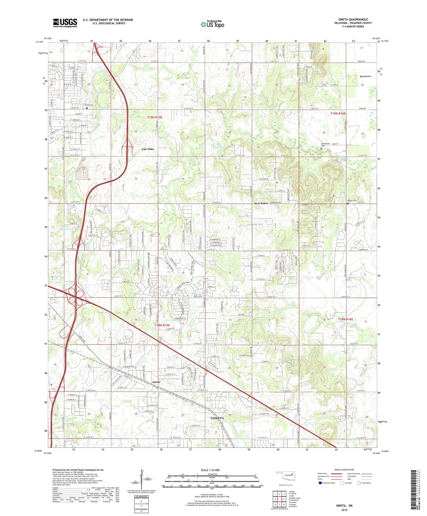
2019 topographic map quadrangle Oneta in the state of Oklahoma. Scale: 1:24000. Based on the newly updated USGS 7.5' US Topo map series, this map is in the following counties: Wagoner. The map contains contour data, water features, and other items you are used to seeing on USGS maps, but also has updated roads and other features. This is the next generation of topographic maps. Printed on high-quality waterproof paper with UV fade-resistant inks.
Quads adjacent to this one:
West: Broken Arrow
Northwest: Mingo
North: Catoosa
Northeast: Inola
East: Catoosa SE
Southeast: Red Bird
South: Coweta
Southwest: Leonard
Contains the following named places: Bailey Cemetery, Blue Springs School, Broken Arrow Fire Department Station 4, Coweta Division, Forest Ridge Baptist Church, Forest Ridge Church of God, KGCT-TV (Tulsa), KJRH-TV (Tulsa), KMYZ-FM (Pryor), KNYD-FM (Broken Arrow), KoeD-TV (Tulsa), KOKI-TV (Tulsa), KOTV-TV (Tulsa), KTFX-FM (Tulsa), KWGS-FM (Tulsa), KWHB-TV (Tulsa), Liberty Elementary School, New Bethel Assembly of God, New Tulsa, Oak Grove School, Oknoname 143016 Dam, Oknoname 143016 Reservoir, Oknoname 145003 Dam, Oknoname 145003 Reservoir, Oneta, Oneta School, Park Lane Elementary School, Smith Cemetery, Springtown Cemetery, Springtown Church, Sunnyside Church, Town of New Tulsa, Township of Adams Creek, Township of Lone Star, ZIP Code: 74014