MyTopo
Catoosa Oklahoma US Topo Map
Couldn't load pickup availability
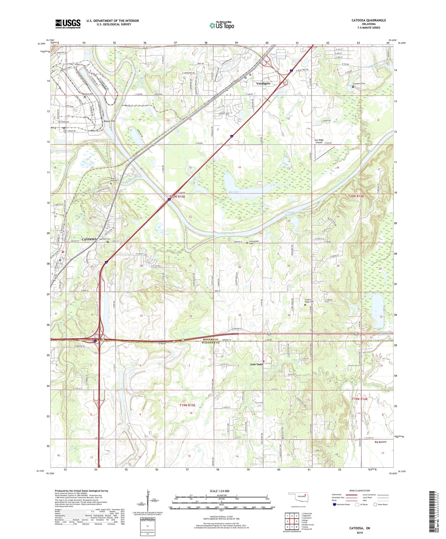
2022 topographic map quadrangle Catoosa in the state of Oklahoma. Scale: 1:24000. Based on the newly updated USGS 7.5' US Topo map series, this map is in the following counties: Rogers, Wagoner. The map contains contour data, water features, and other items you are used to seeing on USGS maps, but also has updated roads and other features. This is the next generation of topographic maps. Printed on high-quality waterproof paper with UV fade-resistant inks.
Quads adjacent to this one:
West: Mingo
Northwest: Collinsville
North: Sageeyah
Northeast: Claremore
East: Inola
Southeast: Catoosa SE
South: Oneta
Southwest: Broken Arrow
This map covers the same area as the classic USGS quad with code o36095b6.
Contains the following named places: Big Lake, Bird Creek, Canyon Lake, Catoosa, Catoosa Fire Department Station 1, Catoosa First Assembly of God, Catoosa Police Department, Catoosa Ultralight Airpark, Catoosa United Methodist Church, Chambers Cemetery, Cherokee Elementary School, Crutchfield Cemetery, Fair Oaks, First Baptist Church, Helen Paul Learning Center, Konklin School, Marshall Cemetery, Mossy Creek, Oak Grove Fire Station, Oknoname 131004 Dam, Oknoname 131004 Reservoir, Oknoname 131005 Dam, Oknoname 131005 Reservoir, Pafford Emergency Medical Services, Port of Catoosa, Rascal Flat, River Hill Cemetery, Rock House, Rogers Landing Public Use Area, Rolling Hills Shopping Center, Sam Riggs Airpark, Silver Lake, Spunky Creek, Timber Ridge Cemetery, Timber Ridge Church, Town of Fair Oaks, Township of Catoosa, Verdigris, Verdigris Church, Verdigris Fire Protection District Fire Station, Verdigris High School, Verdigris Lower Elementary School, Verdigris Police Department, Verdigris Upper Elementary School, Wofford Cemetery, Woodcrest Free Will Baptist Church, Yonkipin Lake, Yonkipin Lake Dam, ZIP Code: 74015