MyTopo
Red Bird Oklahoma US Topo Map
Couldn't load pickup availability
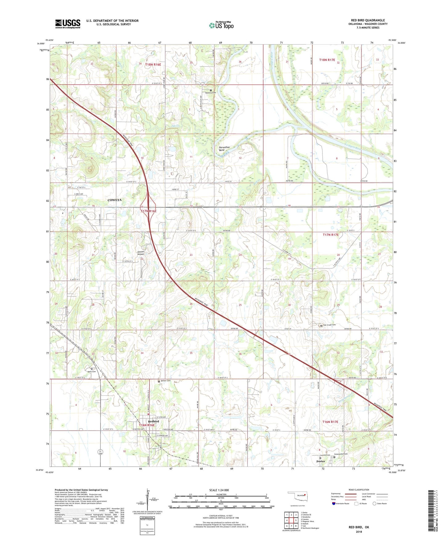
2022 topographic map quadrangle Red Bird in the state of Oklahoma. Scale: 1:24000. Based on the newly updated USGS 7.5' US Topo map series, this map is in the following counties: Wagoner. The map contains contour data, water features, and other items you are used to seeing on USGS maps, but also has updated roads and other features. This is the next generation of topographic maps. Printed on high-quality waterproof paper with UV fade-resistant inks.
Quads adjacent to this one:
West: Coweta
Northwest: Oneta
North: Catoosa SE
Northeast: Neodesha
East: Wagoner West
Southeast: Northwest Muskogee
South: Taft
Southwest: Haskell
This map covers the same area as the classic USGS quad with code o35095h5.
Contains the following named places: Beck Cemetery, Coal Creek, Coweta Junior High School, Fife Creek, Gar Creek, Gar Creek Cemetery, Greenwood Cemetery, Hawkins Cemetery, Horseshoe Bend, Jantzen Airport, KTUL-TV (Tulsa), Lincoln Cemetery, Red Bird, Redbird Cemetery, Town of Red Bird Community Volunteer Fire Department, Town of Redbird, Wagoner County, ZIP Code: 74458