MyTopo
Pearsonia Oklahoma US Topo Map
Couldn't load pickup availability
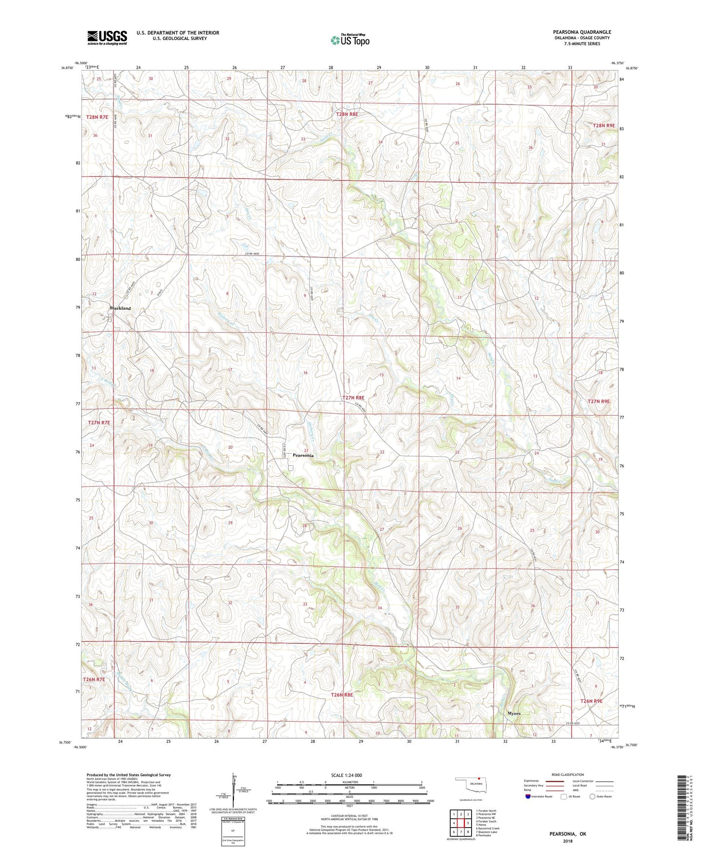
2018 topographic map quadrangle Pearsonia in the state of Oklahoma. Scale: 1:24000. Based on the newly updated USGS 7.5' US Topo map series, this map is in the following counties: Osage. The map contains contour data, water features, and other items you are used to seeing on USGS maps, but also has updated roads and other features. This is the next generation of topographic maps. Printed on high-quality waterproof paper with UV fade-resistant inks.
Quads adjacent to this one:
West: Foraker South
Northwest: Foraker North
North: Pearsonia NW
Northeast: Pearsonia NE
East: Nanos
Southeast: Pawhuska
South: Bluestem Lake
Southwest: Baconrind Creek
Contains the following named places: Blackland, Blackland Rural Fire Department, Dry Creek, Hickory Creek, Myers, North Bird Creek, Oknoname 113117 Dam, Oknoname 113117 Reservoir, Oknoname 113118 Dam, Oknoname 113118 Reservoir, Oknoname 113119 Dam, Oknoname 113119 Reservoir, Oknoname 113120 Dam, Oknoname 113120 Reservoir, Oknoname 113121 Dam, Oknoname 113121 Reservoir, Pearsonia