MyTopo
Foraker North Oklahoma US Topo Map
Couldn't load pickup availability
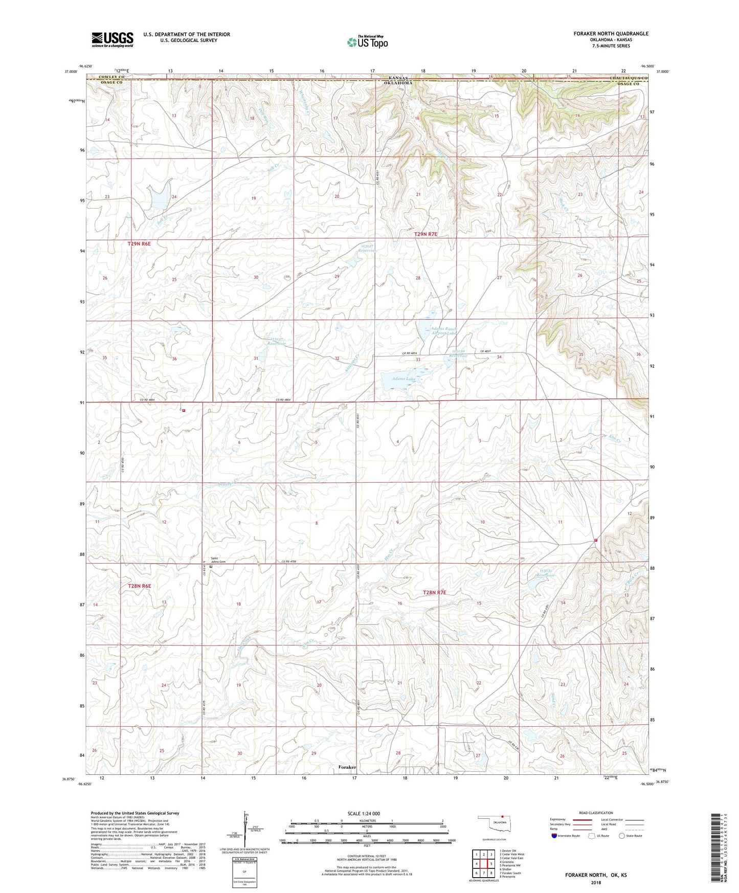
2022 topographic map quadrangle Foraker North in the state of Oklahoma. Scale: 1:24000. Based on the newly updated USGS 7.5' US Topo map series, this map is in the following counties: Osage, Cowley, Chautauqua. The map contains contour data, water features, and other items you are used to seeing on USGS maps, but also has updated roads and other features. This is the next generation of topographic maps. Printed on high-quality waterproof paper with UV fade-resistant inks.
Quads adjacent to this one:
West: Grainola
Northwest: Dexter SW
North: Cedar Vale West
Northeast: Cedar Vale East
East: Pearsonia NW
Southeast: Pearsonia
South: Foraker South
Southwest: Shidler
This map covers the same area as the classic USGS quad with code o36096h5.
Contains the following named places: Adams Lake, Adams Lake Dam, Adams Ranch Airport, Adams Ranch Airport Lake, Adams Ranch Airport Lake Dam, Antelope Creek Rural Fire Department, Big Caney Creek Site 11 Dam, Big Caney Creek Site 11 Reservoir, Buckcreek Rural Fire Department, Oknoname 113052 Dam, Oknoname 113052 Reservoir, Oknoname 113053 Dam, Oknoname 113053 Reservoir, Oknoname 113127 Dam, Oknoname 113127 Reservoir, Oknoname 113130 Dam, Oknoname 113130 Reservoir, Oknoname 113131 Dam, Oknoname 113131 Reservoir, Oknoname 113132 Dam, Oknoname 113132 Reservoir, Oknoname 113133 Dam, Oknoname 113133 Reservoir, Oknoname 113134 Dam, Oknoname 113134 Reservoir, Oknoname 113135 Dam, Oknoname 113135 Reservoir, Oknoname 113136 Dam, Oknoname 113136 Reservoir, Oknoname 113137 Dam, Oknoname 113137 Reservoir, Oknoname 113138 Dam, Oknoname 113138 Reservoir, Saint Johns Cemetery, Township of Foraker