MyTopo
Foraker South Oklahoma US Topo Map
Couldn't load pickup availability
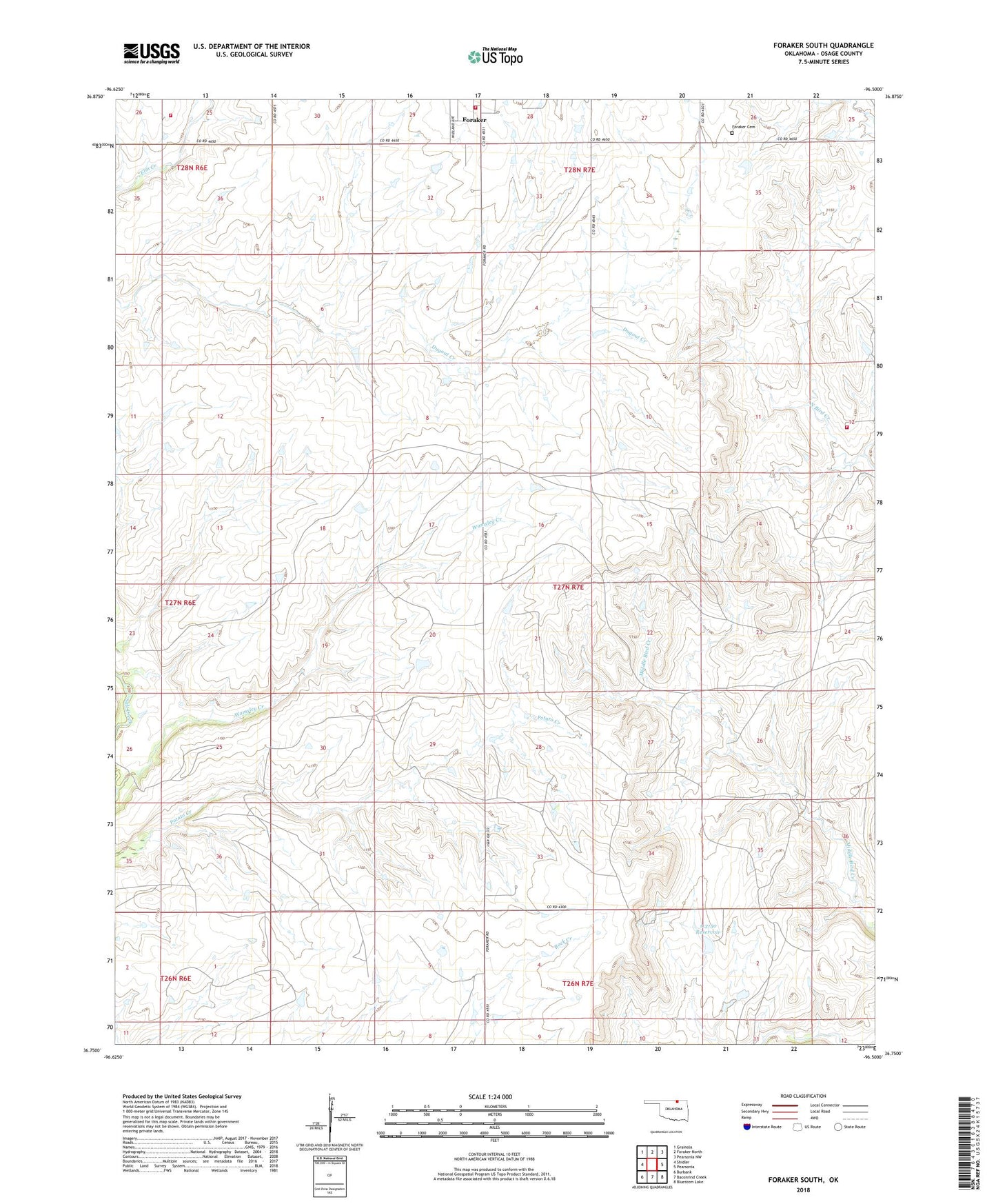
2022 topographic map quadrangle Foraker South in the state of Oklahoma. Scale: 1:24000. Based on the newly updated USGS 7.5' US Topo map series, this map is in the following counties: Osage. The map contains contour data, water features, and other items you are used to seeing on USGS maps, but also has updated roads and other features. This is the next generation of topographic maps. Printed on high-quality waterproof paper with UV fade-resistant inks.
Quads adjacent to this one:
West: Shidler
Northwest: Grainola
North: Foraker North
Northeast: Pearsonia NW
East: Pearsonia
Southeast: Bluestem Lake
South: Baconrind Creek
Southwest: Burbank
This map covers the same area as the classic USGS quad with code o36096g5.
Contains the following named places: Codding Cattle Research Airport, Codding Ranch, Foraker, Foraker Cemetery, Foraker Volunteer Fire Department, McKinney Ranch Airport, Northwest Osage Division, Oknoname 113150 Dam, Oknoname 113150 Reservoir, Osage Wildlife Managment Area, Town of Foraker, Wamsley Creek Rural Fire Department