MyTopo
Perry NW Oklahoma US Topo Map
Couldn't load pickup availability
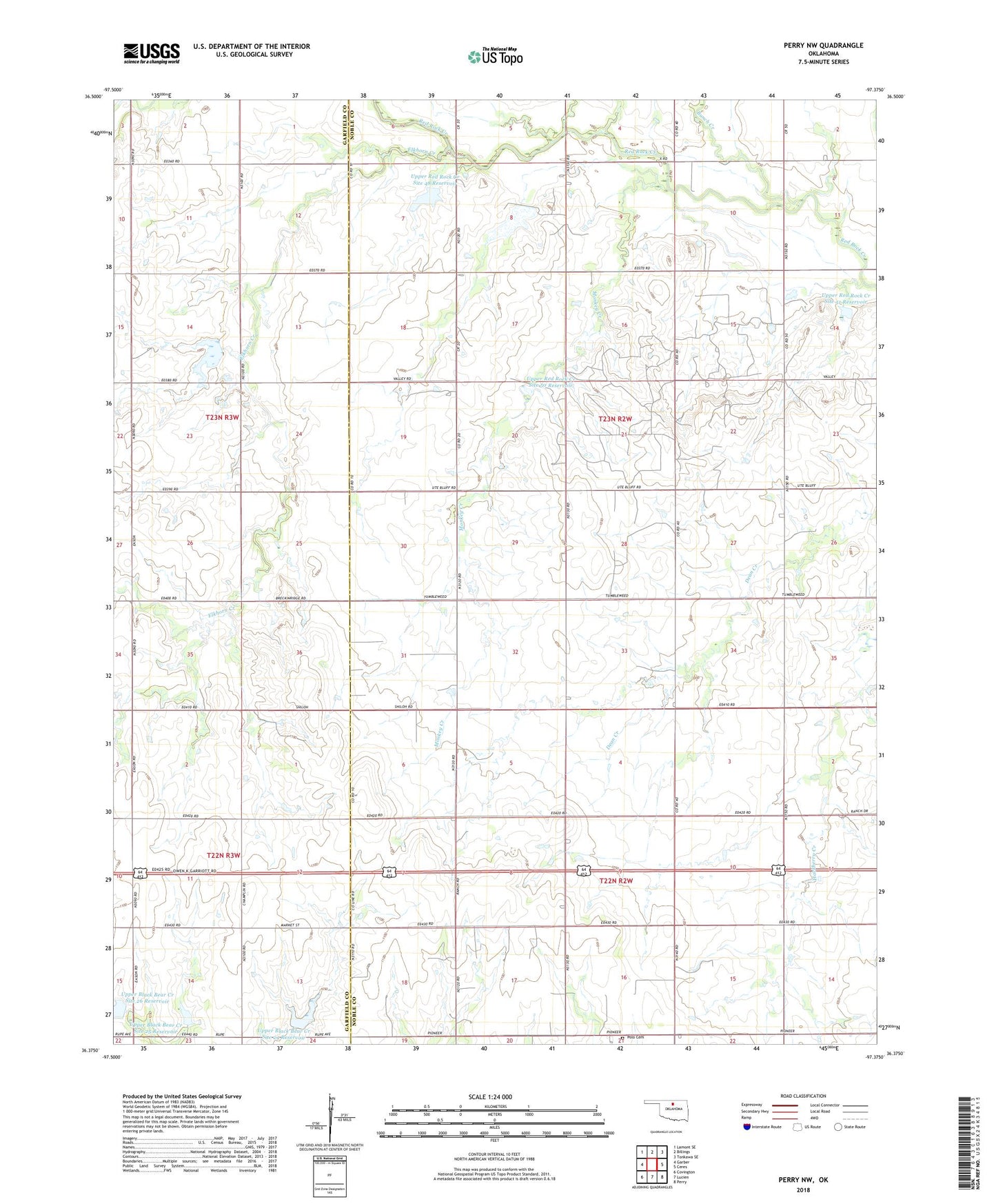
2018 topographic map quadrangle Perry NW in the state of Oklahoma. Scale: 1:24000. Based on the newly updated USGS 7.5' US Topo map series, this map is in the following counties: Noble, Garfield. The map contains contour data, water features, and other items you are used to seeing on USGS maps, but also has updated roads and other features. This is the next generation of topographic maps. Printed on high-quality waterproof paper with UV fade-resistant inks.
Quads adjacent to this one:
West: Garber
Northwest: Lamont SE
North: Billings
Northeast: Tonkawa SE
East: Ceres
Southeast: Perry
South: Lucien
Southwest: Covington
Contains the following named places: Antelope Valley Church, Bunch Creek, Elkhorn Creek, Monkey Creek, Polo Cemetery, Township of White Rock, Upper Black Bear Creek Site 24 Dam, Upper Black Bear Creek Site 24 Reservoir, Upper Black Bear Creek Site 25 Dam, Upper Black Bear Creek Site 25 Reservoir, Upper Black Bear Creek Site 26 Dam, Upper Black Bear Creek Site 26 Reservoir, Upper Red Rock Creek Site 39 Dam, Upper Red Rock Creek Site 39 Reservoir, Upper Red Rock Creek Site 46 Dam, Upper Red Rock Creek Site 46 Reservoir, Upper Red Rock Creek Site 48 Dam, Upper Red Rock Creek Site 48 Reservoir, Upper Red Rock Creek Site 50 Dam, Upper Red Rock Creek Site 50 Reservoir, Upper Red Rock Creek Site 51 Dam, Upper Red Rock Creek Site 51 Reservoir, Upper Red Rock Creek Site 53 Dam, Upper Red Rock Creek Site 53 Reservoir, Upper Red Rock Creek Site Number 47 Dam, Upper Red Rock Creek Site Number 47 Reservoir