MyTopo
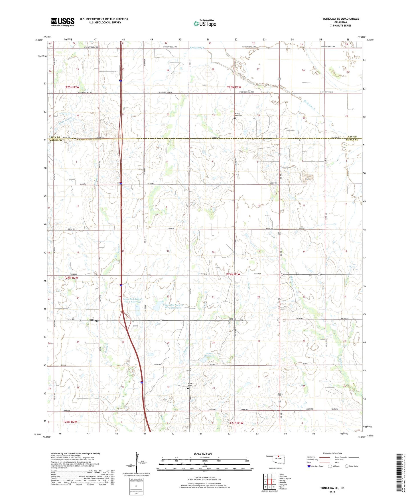
Tonkawa SE Oklahoma US Topo Map
Couldn't load pickup availability
2022 topographic map quadrangle Tonkawa SE in the state of Oklahoma. Scale: 1:24000. Based on the newly updated USGS 7.5' US Topo map series, this map is in the following counties: Noble, Kay. The map contains contour data, water features, and other items you are used to seeing on USGS maps, but also has updated roads and other features. This is the next generation of topographic maps. Printed on high-quality waterproof paper with UV fade-resistant inks.
Quads adjacent to this one:
West: Billings
Northwest: Eddy
North: Tonkawa
Northeast: Ponca City NW
East: Marland
Southeast: Red Rock
South: Ceres
Southwest: Perry NW
This map covers the same area as the classic USGS quad with code o36097e3.
Contains the following named places: Billings Division, Floral Ridge Cemetery, Freedom Church, Oknoname 103010 Dam, Oknoname 103010 Reservoir, Prairie View Cemetery, South Tonkawa Gas Field, Tonkawa Oil Field, Township of Glenrose, Upper Red Rock Creek Site 3 Dam, Upper Red Rock Creek Site 3 Reservoir, Upper Red Rock Creek Site 5 Dam, Upper Red Rock Creek Site 5 Reservoir, Upper Red Rock Creek Site 6 Dam, Upper Red Rock Creek Site 6 Reservoir