MyTopo
Prague SE Oklahoma US Topo Map
Couldn't load pickup availability
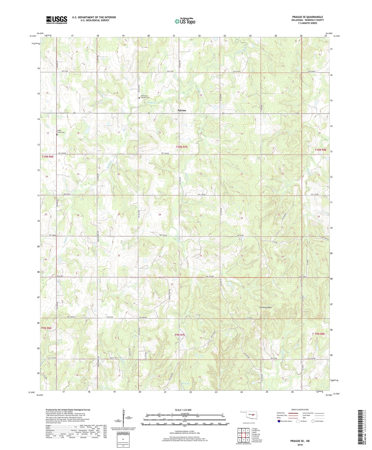
2018 topographic map quadrangle Prague SE in the state of Oklahoma. Scale: 1:24000. Based on the newly updated USGS 7.5' US Topo map series, this map is in the following counties: Seminole. The map contains contour data, water features, and other items you are used to seeing on USGS maps, but also has updated roads and other features. This is the next generation of topographic maps. Printed on high-quality waterproof paper with UV fade-resistant inks.
Quads adjacent to this one:
West: Prague SW
Northwest: Prague
North: Prague NE
Northeast: Boley
East: Cromwell
Southeast: Wewoka East
South: Wewoka West
Southwest: Seminole
Contains the following named places: Bethel Oil Field, Big Wewoka Creek Site 10 Dam, Big Wewoka Creek Site 10 Reservoir, Chimney Rock, East Sylvian Oil Field, Ferguson Church, Fry Lake, Haney Church, Hitchitee Church Cemetery, North Bethel Oil Field, Pleasant Ridge Church, Seminole Oil Field, Seminole-Hitchiti United Methodist Church, Snake Creek, Snake Creek Church, Snake Creek Indian Baptist Church Number 2 Cemetery, Sylvian, Sylvian Oil Field, Tallahassee Church, Township of Red Mound