MyTopo
Prague Oklahoma US Topo Map
Couldn't load pickup availability
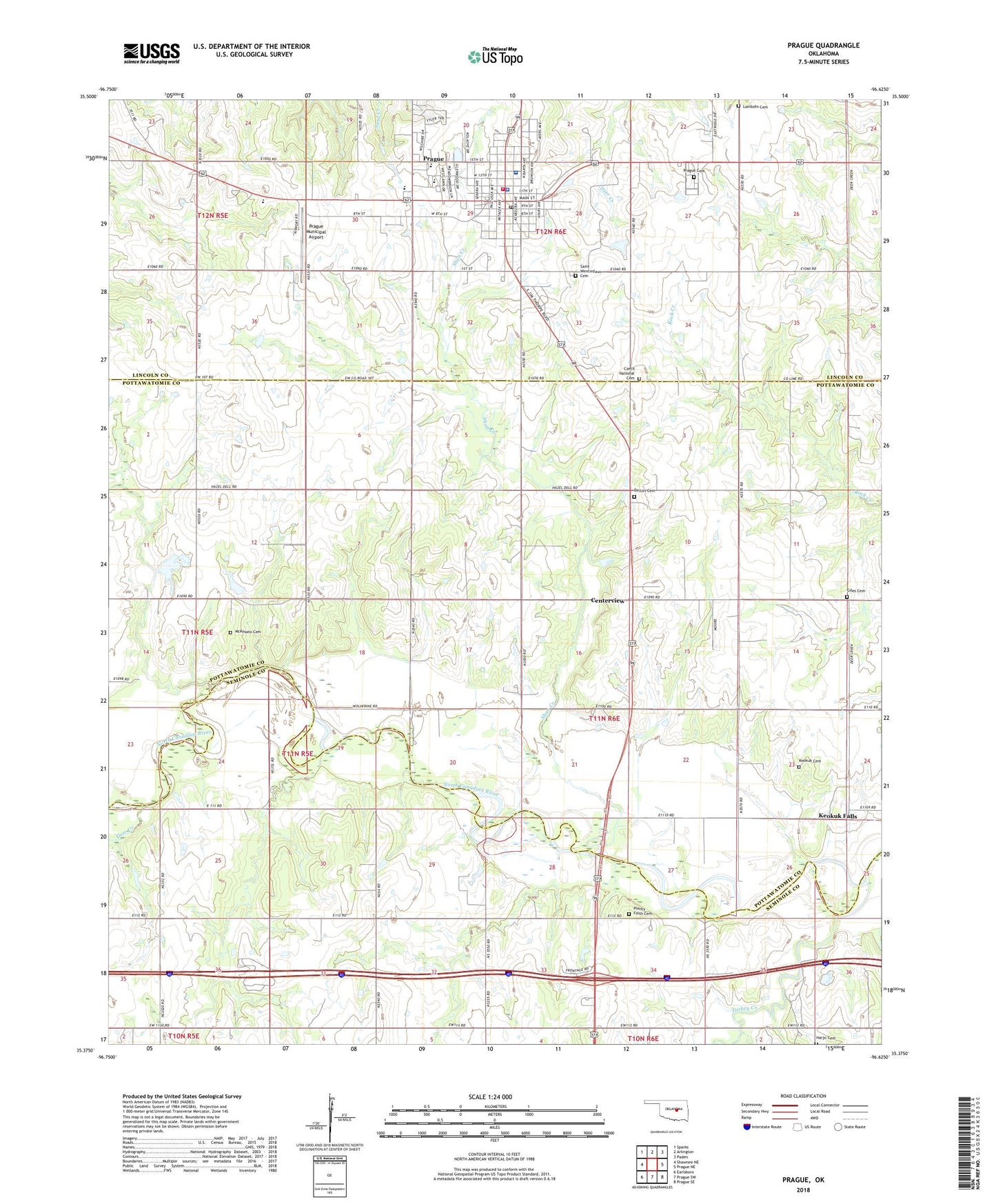
2022 topographic map quadrangle Prague in the state of Oklahoma. Scale: 1:24000. Based on the newly updated USGS 7.5' US Topo map series, this map is in the following counties: Pottawatomie, Lincoln, Seminole. The map contains contour data, water features, and other items you are used to seeing on USGS maps, but also has updated roads and other features. This is the next generation of topographic maps. Printed on high-quality waterproof paper with UV fade-resistant inks.
Quads adjacent to this one:
West: Shawnee NE
Northwest: Sparks
North: Arlington
Northeast: Paden
East: Prague NE
Southeast: Prague SE
South: Prague SW
Southwest: Earlsboro
This map covers the same area as the classic USGS quad with code o35096d6.
Contains the following named places: Barton, Centerview, City of Prague, Czech National Cemetery, Dalton Family Cemetery, Deer Creek, Giles Cemetery, Harjo Cemetery, Keokuk Cemetery, Keokuk Falls, Lambdin Cemetery, Lighthouse Christian Academy, McKosato Cemetery, Oknoname 12521 Dam, Oknoname 12521 Reservoir, Oknoname 12522 Dam, Oknoname 12522 Reservoir, Pleasant Home Church, Plenty Fay Cemetery, Prague, Prague Catholic Cemetery, Prague Cemetery, Prague Elementary School, Prague Fire Department, Prague High School, Prague Middle School, Prague Municipal Airport, Prague Municipal Hospital, Prague Oil Field, Prague Police Department, Prague Post Office, Provaznik Creek, React Emergency Medical Services Station 4, Shan Creek, Township of Dent, Turkey Creek, West Prague Oil Field, ZIP Code: 74864