MyTopo
Pryor Oklahoma US Topo Map
Couldn't load pickup availability
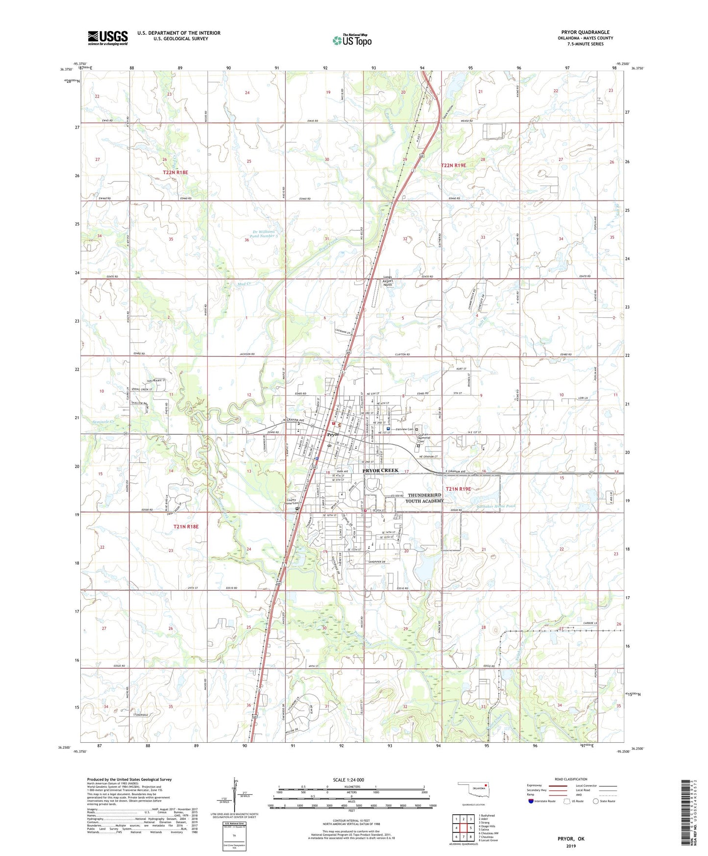
2019 topographic map quadrangle Pryor in the state of Oklahoma. Scale: 1:24000. Based on the newly updated USGS 7.5' US Topo map series, this map is in the following counties: Mayes. The map contains contour data, water features, and other items you are used to seeing on USGS maps, but also has updated roads and other features. This is the next generation of topographic maps. Printed on high-quality waterproof paper with UV fade-resistant inks.
Quads adjacent to this one:
West: Osage Hills
Northwest: Bushyhead
North: Adair
Northeast: Strang
East: Salina
Southeast: Locust Grove
South: Chouteau
Southwest: Chouteau NW
Contains the following named places: Center 69, Church of Christ, Church of God, Church of the Nazarene First, City of Pryor Creek, County Home Cemetery, Dr Williams Pond Number 5, Dr Williams Pond Number 5 Dam, Fairview Cemetery, First Baptist Church, First Christian Disciples Church, First Church of God, First Free Will Baptist Church, First United Methodist Church, Graham Memorial Cemetery, Immanuel Baptist Church, Integris Mayes County Medical Center, Jefferson Elementary School, Kingdom Hall Jehovahs Witnesses, KMYZ-AM (Pryor), Lincoln Elementary School, Longs Airport North, Mayes County Sheriff's Office, Mud Creek, Presybterian Church, Pryor, Pryor Fire Department, Pryor Apostolic Church, Pryor Beauty College, Pryor Fire Department Station 1 Headquarters, Pryor First Assembly of God, Pryor High School, Pryor Junior High School, Pryor Missionary Baptist Church, Pryor Police Department, Pryor Post Office, Roosevelt Lower Elementary School, Saint Johns Lutheran Church, Saint Marks School, Saint Martin Tours Episcopal Church, Salt Branch, Scarbow Lake, Scarbow Lake Dam, Seminole Creek, Southside Christian Preschool, Squaw Creek, Squaw Hollow, Sulphur Creek, Tiger Plaza, Township of Hogan, Victory Baptist Church, Washington Elementary School, Westside Freewill Baptist Church, Westside Park, Whitaker Home Pond, Whitaker Home Pond Dam, Whitaker Park, Whitaker State Childrens Home, Whittaker Army Heliport, William Bradford Christian School, ZIP Code: 74361