MyTopo
Chouteau NW Oklahoma US Topo Map
Couldn't load pickup availability
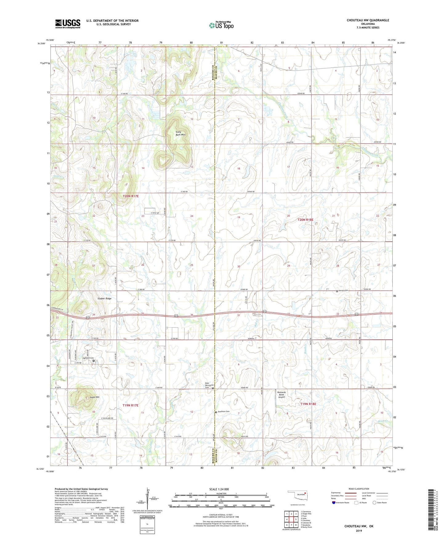
2022 topographic map quadrangle Chouteau NW in the state of Oklahoma. Scale: 1:24000. Based on the newly updated USGS 7.5' US Topo map series, this map is in the following counties: Mayes, Rogers. The map contains contour data, water features, and other items you are used to seeing on USGS maps, but also has updated roads and other features. This is the next generation of topographic maps. Printed on high-quality waterproof paper with UV fade-resistant inks.
Quads adjacent to this one:
West: Inola
Northwest: Claremore
North: Osage Hills
Northeast: Pryor
East: Chouteau
Southeast: Rocky Point
South: Neodesha
Southwest: Catoosa SE
This map covers the same area as the classic USGS quad with code o36095b4.
Contains the following named places: Amish Cemetery, Brethren Cemetery, Buzzards Roost Airport, Eden Church, Eden Mennonite Cemetery, Highland Cemetery, Inola Hill, Scaly Bark Mountain, Timber Ridge