MyTopo
Rocky Ford Oklahoma US Topo Map
Couldn't load pickup availability
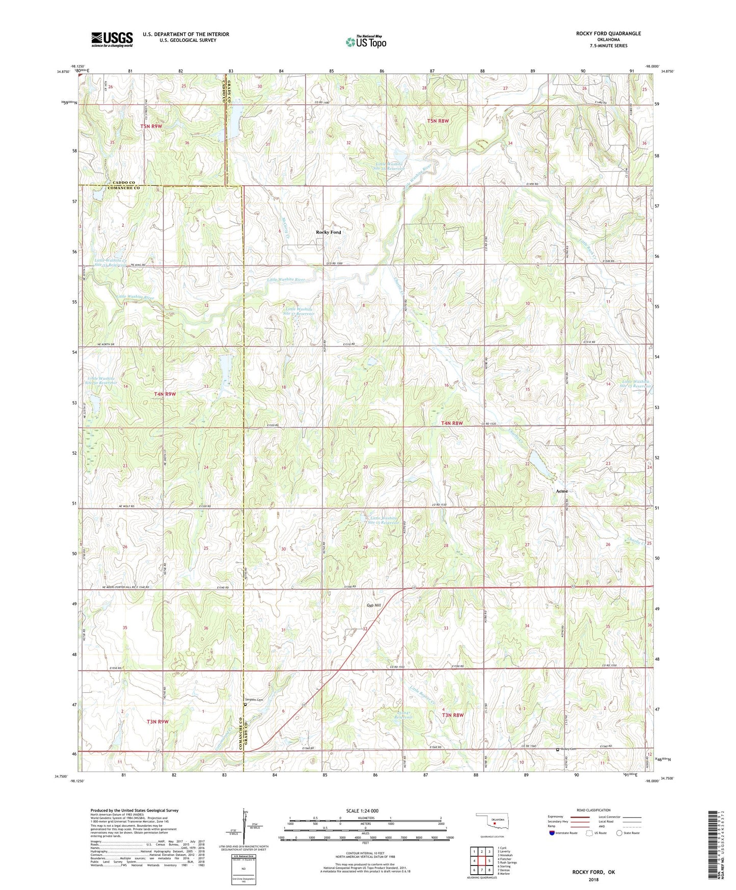
2018 topographic map quadrangle Rocky Ford in the state of Oklahoma. Scale: 1:24000. Based on the newly updated USGS 7.5' US Topo map series, this map is in the following counties: Grady, Comanche, Caddo. The map contains contour data, water features, and other items you are used to seeing on USGS maps, but also has updated roads and other features. This is the next generation of topographic maps. Printed on high-quality waterproof paper with UV fade-resistant inks.
Quads adjacent to this one:
West: Fletcher
Northwest: Cyril
North: Laverty
Northeast: Ninnekah
East: Rush Springs
Southeast: Marlow
South: Denton
Southwest: Sterling
Contains the following named places: Acme, Cedar Grove Church, Charlie Creek, Gyp Hill, Little Rush Creek, Little Washita Creek Site 18 Dam, Little Washita Creek Site 18 Reservoir, Little Washita Creek Site 32 Dam, Little Washita Creek Site 32 Reservoir, Little Washita Creek Site 33 Dam, Little Washita Creek Site 33 Reservoir, Little Washita Site 14 Dam, Little Washita Site 14 Reservoir, Little Washita Site 15 Dam, Little Washita Site 15 Reservoir, Little Washita Site 17 Dam, Little Washita Site 17 Reservoir, Little Washita Site 34 Dam, Little Washita Site 34 Reservoir, Little Washita Site 35 Dam, Little Washita Site 35 Reservoir, Little Washita Site 50 Dam, Little Washita Site 50 Reservoir, McCarty Creek, Oknoname 051047 Dam, Oknoname 051047 Reservoir, Ridley Cemetery, Rocky Ford, Simpson Cemetery, Township of Cross