MyTopo
Laverty Oklahoma US Topo Map
Couldn't load pickup availability
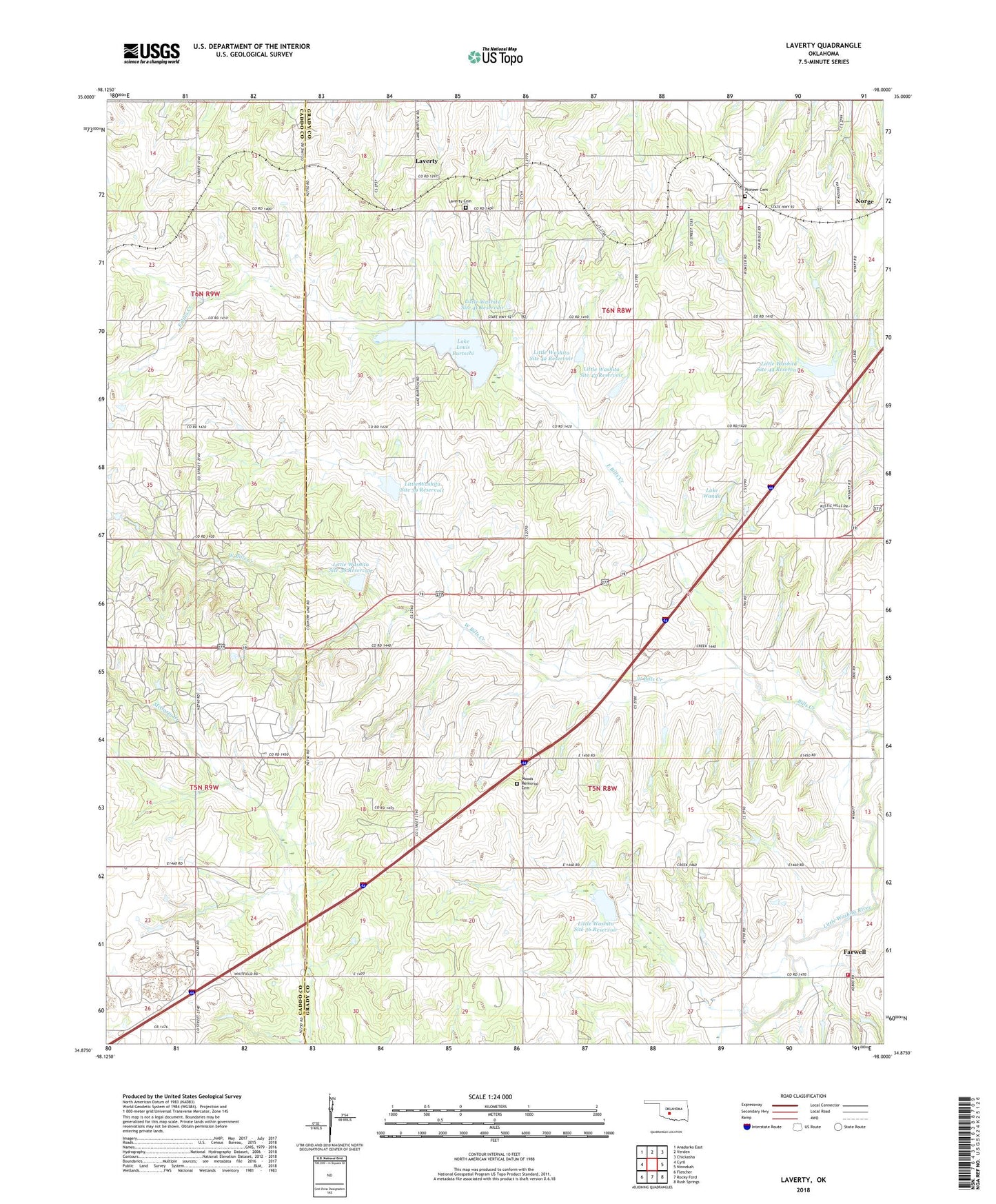
2022 topographic map quadrangle Laverty in the state of Oklahoma. Scale: 1:24000. Based on the newly updated USGS 7.5' US Topo map series, this map is in the following counties: Grady, Caddo. The map contains contour data, water features, and other items you are used to seeing on USGS maps, but also has updated roads and other features. This is the next generation of topographic maps. Printed on high-quality waterproof paper with UV fade-resistant inks.
Quads adjacent to this one:
West: Cyril
Northwest: Anadarko East
North: Verden
Northeast: Chickasha
East: Ninnekah
Southeast: Rush Springs
South: Rocky Ford
Southwest: Fletcher
This map covers the same area as the classic USGS quad with code o34098h1.
Contains the following named places: Bills Creek, Boggy Creek, Chickasha Division, East Bills Creek, Fairview School, Farwell, Grady County Fire Department Farwell Station, Grady County Fire Department Pioneer Station, Kechi School, Lake Lewis Burtschi, Lake Lewis Burtschi Dam, Lake Louis Burtschi, Lake Louis Burtschi State Game Reservation, Lake Wanda, Laverty, Laverty Cemetery, Laverty Church, Little Washita Site 36 Dam, Little Washita Site 36 Reservoir, Little Washita Site 38 Dam, Little Washita Site 38 Reservoir, Little Washita Site 39 Dam, Little Washita Site 39 Reservoir, Little Washita Site 41 Dam, Little Washita Site 41 Reservoir, Little Washita Site 42 Dam, Little Washita Site 42 Reservoir, Little Washita Site 43 Dam, Little Washita Site 43 Reservoir, Little Washita Site 44 Dam, Little Washita Site 44 Reservoir, Pioneer Cemetery, Pioneer Church, Pioneer Elementary School, Township of Chandler, Township of Hillsboro, West Bills Creek, Woods Memorial Cemetery, Woods Memorial Church, ZIP Code: 73017