MyTopo
Marlow Oklahoma US Topo Map
Couldn't load pickup availability
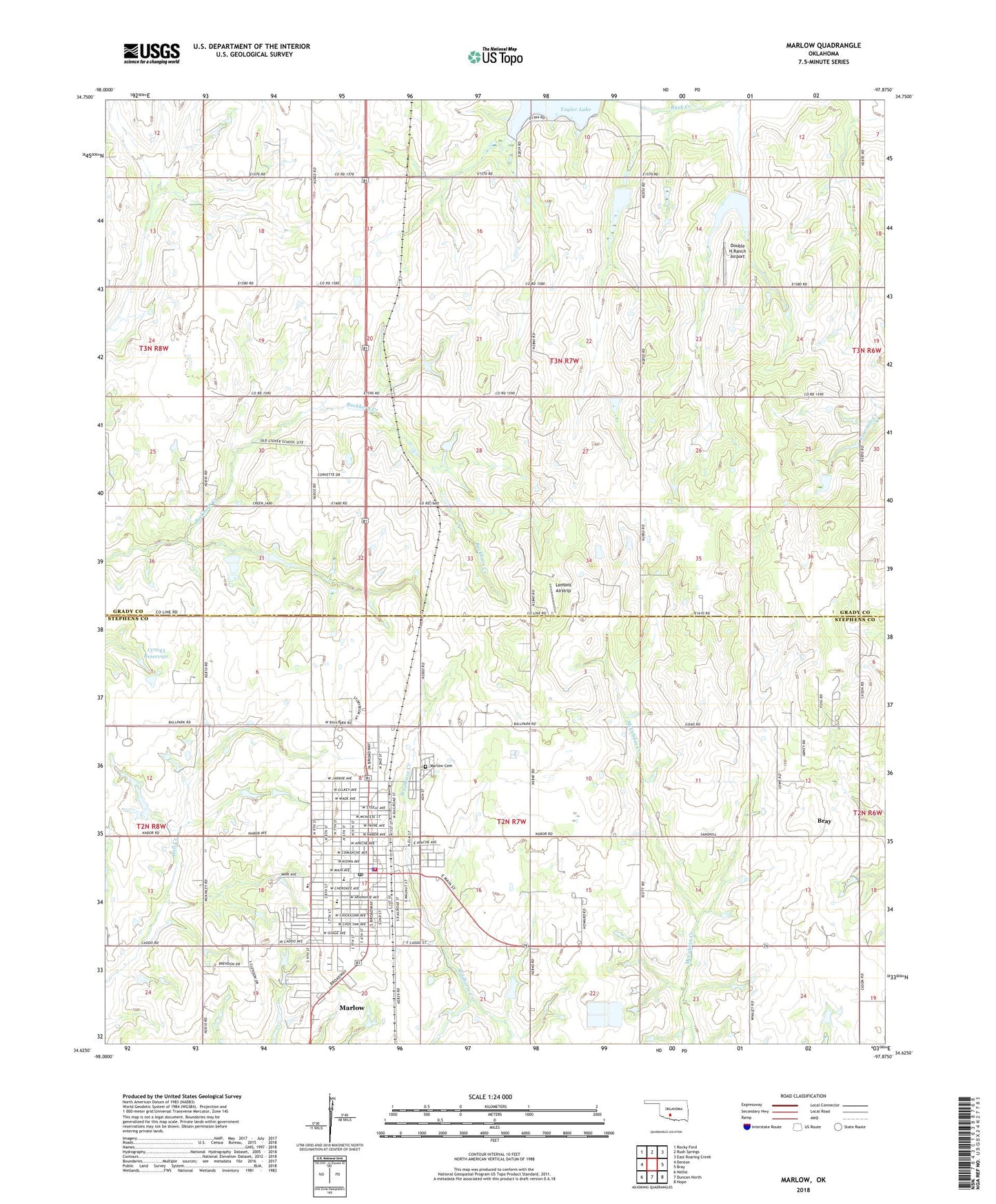
2022 topographic map quadrangle Marlow in the state of Oklahoma. Scale: 1:24000. Based on the newly updated USGS 7.5' US Topo map series, this map is in the following counties: Grady, Stephens. The map contains contour data, water features, and other items you are used to seeing on USGS maps, but also has updated roads and other features. This is the next generation of topographic maps. Printed on high-quality waterproof paper with UV fade-resistant inks.
Quads adjacent to this one:
West: Denton
Northwest: Rocky Ford
North: Rush Springs
Northeast: East Roaring Creek
East: Bray
Southeast: Hope
South: Duncan North
Southwest: Nellie
This map covers the same area as the classic USGS quad with code o34097f8.
Contains the following named places: American Medical Response Marlow, Christian Church, City of Marlow, Double H Ranch Airport, East Side Baptist Church, First Assembly of God Church, First Baptist Church of Marlow, Lemons Airstrip, Marlow, Marlow Cemetery, Marlow City Police Department, Marlow Elementary School, Marlow Fire Department, Marlow High School, Marlow Middle School, Marlow Post Office, Oknoname 137043 Dam, Oknoname 137043 Reservoir, Red Bud Park, Rush Creek Site 1 Dam, Rush Creek Site 1 Reservoir, Rush Creek Site 101 Dam, Rush Creek Site 101 Reservoir, Rush Creek Site 103 Dam, Rush Creek Site 103 Reservoir, Rush Creek Site 105 Dam, Rush Creek Site 105 Reservoir, Rush Creek Site 2 Dam, Rush Creek Site 2 Reservoir, Rush Creek Site 4 Dam, Rush Creek Site 4 Reservoir, Stone Park, Stover School, Trail School, ZIP Code: 73055