MyTopo
Rush Springs Oklahoma US Topo Map
Couldn't load pickup availability
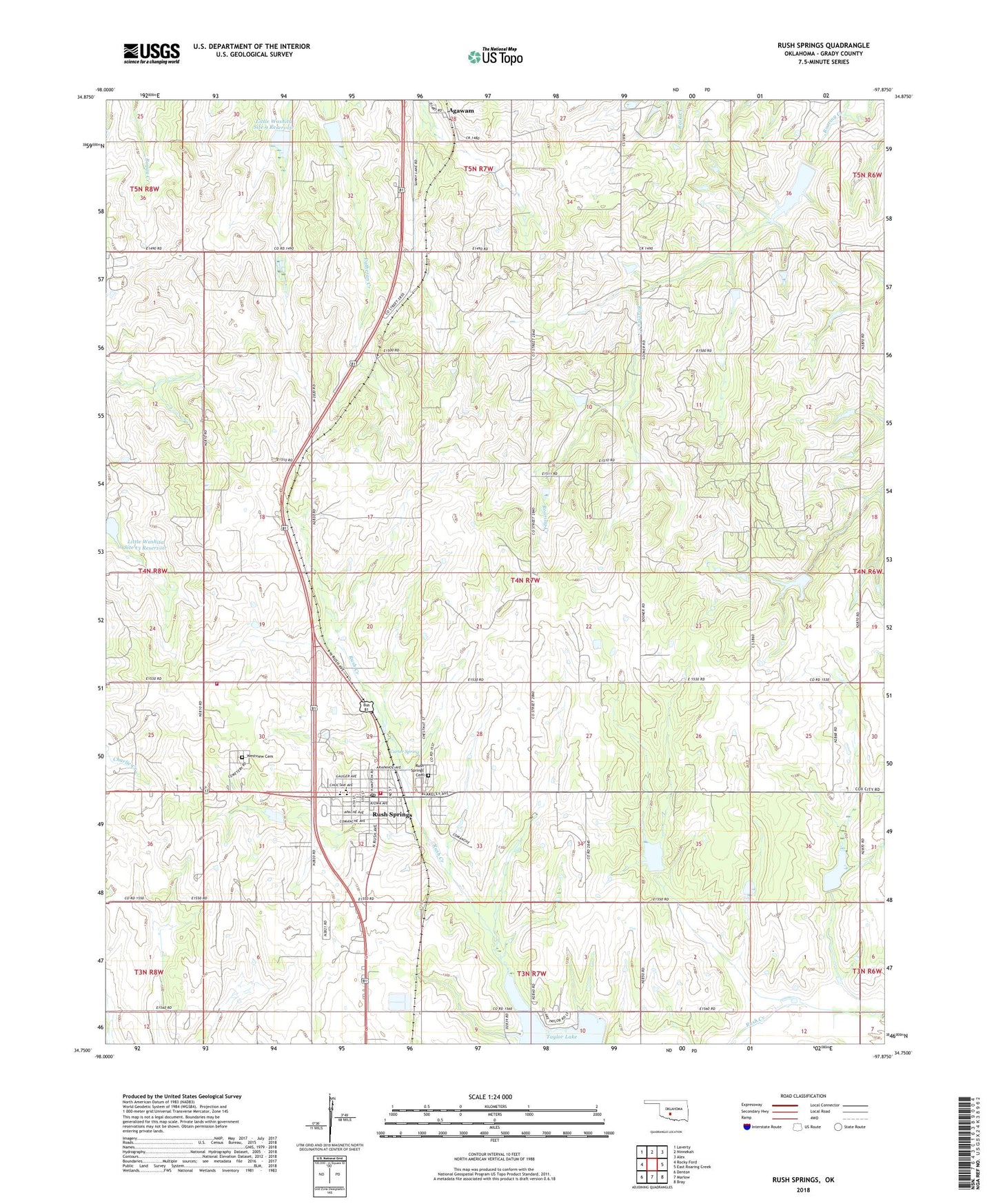
2018 topographic map quadrangle Rush Springs in the state of Oklahoma. Scale: 1:24000. Based on the newly updated USGS 7.5' US Topo map series, this map is in the following counties: Grady. The map contains contour data, water features, and other items you are used to seeing on USGS maps, but also has updated roads and other features. This is the next generation of topographic maps. Printed on high-quality waterproof paper with UV fade-resistant inks.
Quads adjacent to this one:
West: Rocky Ford
Northwest: Laverty
North: Ninnekah
Northeast: Alex
East: East Roaring Creek
Southeast: Bray
South: Marlow
Southwest: Denton
Contains the following named places: Agawam, Carter Spring, Elm Flat School, Grady County Fire Department Acme Station, Little Washita Site 13 Dam, Little Washita Site 13 Reservoir, Little Washita Site 8 Dam, Little Washita Site 8 Reservoir, Little Washita Site 9 Dam, Little Washita Site 9 Reservoir, Roaring Creek Site 102 Dam, Roaring Creek Site 102 Reservoir, Roaring Creek Site 103 Dam, Roaring Creek Site 103 Reservoir, Roaring Creek Site 104 Dam, Roaring Creek Site 104 Reservoir, Roaring Creek Site 16a Dam, Roaring Creek Site 16a Reservoir, Roaring Creek Site 9 Dam, Roaring Creek Site 9 Reservoir, Rocky Point School, Rush Creek Site 3 Dam, Rush Creek Site 3 Reservoir, Rush Creek Site 49 Dam, Rush Creek Site 49 Reservoir, Rush Creek Site 5 Dam, Rush Creek Site 5 Reservoir, Rush Creek Site 6 Dam, Rush Creek Site 6 Reservoir, Rush Springs, Rush Springs Cemetery, Rush Springs Division, Rush Springs Elementary School, Rush Springs Emergency Medical Services, Rush Springs Fire Department, Rush Springs High School, Rush Springs Middle School, Rush Springs Post Office, Sperling School, Taylor Lake, Town of Rush Springs, Township of Rush Springs, Westview Cemetery, ZIP Code: 73082