MyTopo
Sentinel Oklahoma US Topo Map
Couldn't load pickup availability
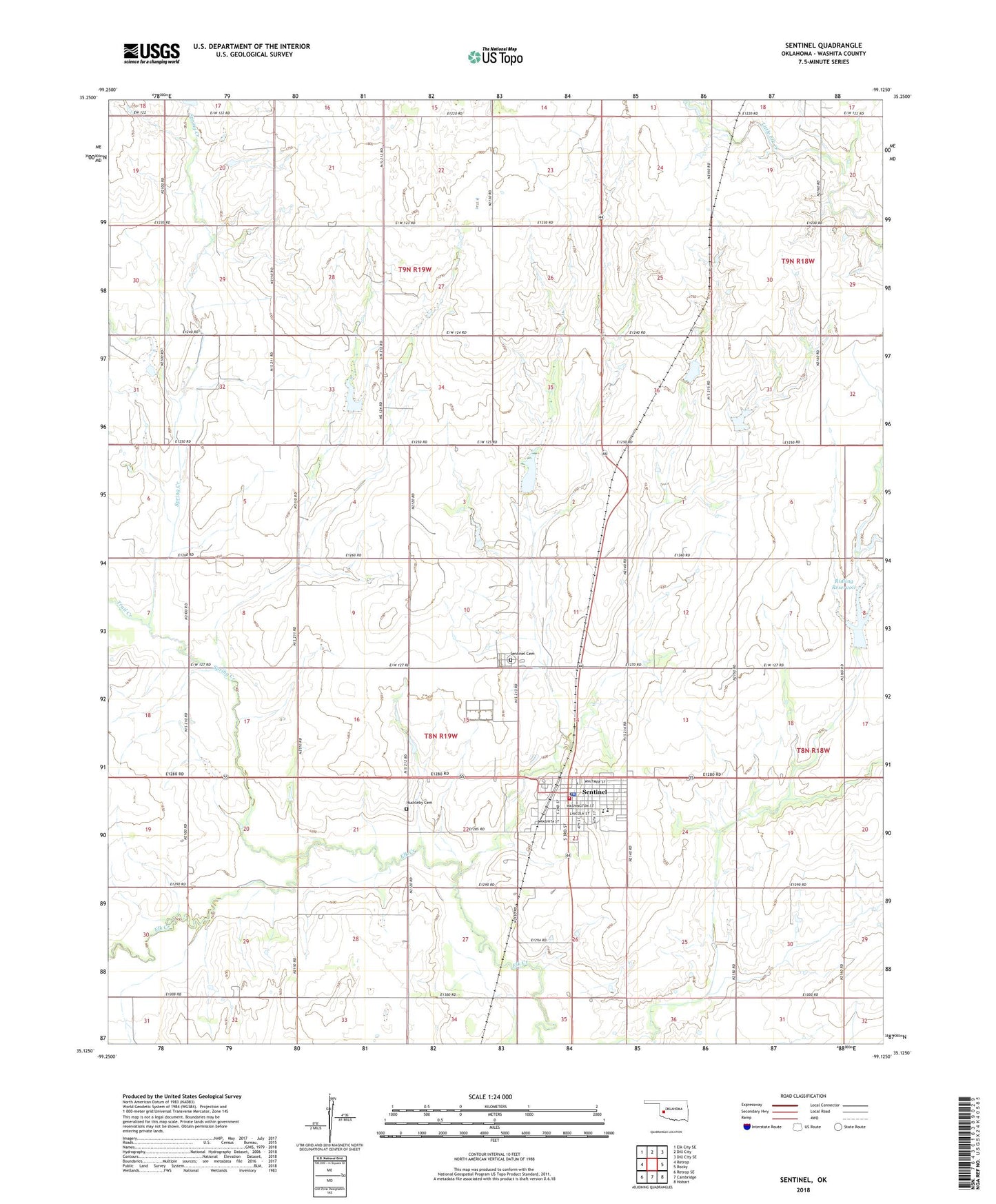
2018 topographic map quadrangle Sentinel in the state of Oklahoma. Scale: 1:24000. Based on the newly updated USGS 7.5' US Topo map series, this map is in the following counties: Washita. The map contains contour data, water features, and other items you are used to seeing on USGS maps, but also has updated roads and other features. This is the next generation of topographic maps. Printed on high-quality waterproof paper with UV fade-resistant inks.
Quads adjacent to this one:
West: Retrop
Northwest: Elk City SE
North: Dill City
Northeast: Dill City SE
East: Rocky
Southeast: Hobart
South: Cambridge
Southwest: Retrop SE
Contains the following named places: Baptist Church, Blanche Thomas High School, Church of Christ, First Assembly of God, Huckleby Cemetery, McMurray Elementary School, Methodist Church, Myron Straub Dam, Myron Straub Reservoir, Ridling Dam, Ridling Reservoir, Sentinel, Sentinel Cemetery, Sentinel City Ambulance Service, Sentinel Police Department, Sentinel Post Office, Sentinel Volunteer Fire Department, South Burns Church, Southwest Washita Division, Spring Creek, Town of Sentinel, Township of North Elk, Township of South Elk, Trail Creek, Upper Elk Creek Site 10 Dam, Upper Elk Creek Site 10 Reservoir, Upper Elk Creek Site 5 Dam, Upper Elk Creek Site 5 Reservoir, Upper Elk Creek Site 6 Dam, Upper Elk Creek Site 6 Reservoir, Upper Elk Creek Site 8 Dam, Upper Elk Creek Site 8 Reservoir, ZIP Code: 73664