MyTopo
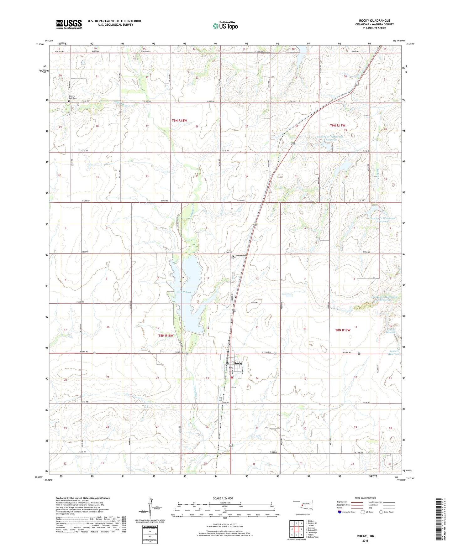
Rocky Oklahoma US Topo Map
Couldn't load pickup availability
2022 topographic map quadrangle Rocky in the state of Oklahoma. Scale: 1:24000. Based on the newly updated USGS 7.5' US Topo map series, this map is in the following counties: Washita. The map contains contour data, water features, and other items you are used to seeing on USGS maps, but also has updated roads and other features. This is the next generation of topographic maps. Printed on high-quality waterproof paper with UV fade-resistant inks.
Quads adjacent to this one:
West: Sentinel
Northwest: Dill City
North: Dill City SE
Northeast: Cordell
East: Gotebo NW
Southeast: Gotebo West
South: Hobart
Southwest: Cambridge
This map covers the same area as the classic USGS quad with code o35099b1.
Contains the following named places: Cavalry Creek Watershed 12 Dam, Cavalry Creek Watershed 12 Reservoir, Cavalry Creek Watershed 13 Dam, Cavalry Creek Watershed 13 Reservoir, Cavalry Creek Watershed 14 Dam, Cavalry Creek Watershed 14 Reservoir, Cavalry Creek Watershed 15 Dam, Cavalry Creek Watershed 15 Reservoir, Cavalry Creek Watershed 30 Dam, Cavalry Creek Watershed 30 Reservoir, Cavalry Creek Watershed 8 Dam, Cavalry Creek Watershed 8 Reservoir, Church of First Born, Grissom Cemetery, Lake Hobart, Liberty Bell Cemetery, Lone Star Cemetery, Oknoname 149026 Dam, Oknoname 149026 Reservoir, Oknoname 149027 Dam, Oknoname 149029 Dam, Oknoname 149029 Reservoir, Oknoname 149033 Dam, Oknoname 149033 Reservoir, Oknoname 149034 Dam, Oknoname 149034 Reservoir, Rocky, Rocky Post Office, Rocky Volunteer Fire Department, Town of Rocky, ZIP Code: 73661