MyTopo
Sickles Oklahoma US Topo Map
Couldn't load pickup availability
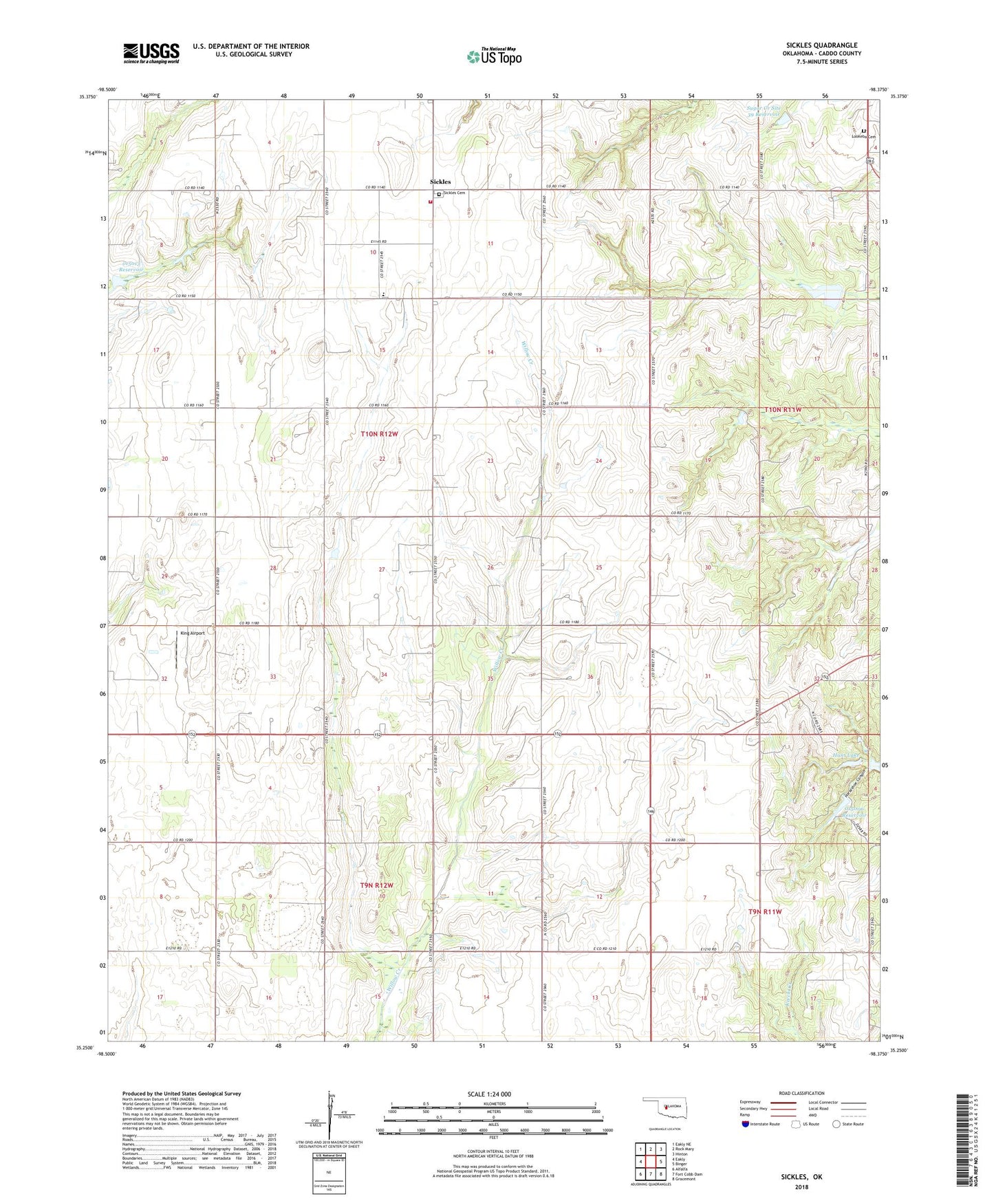
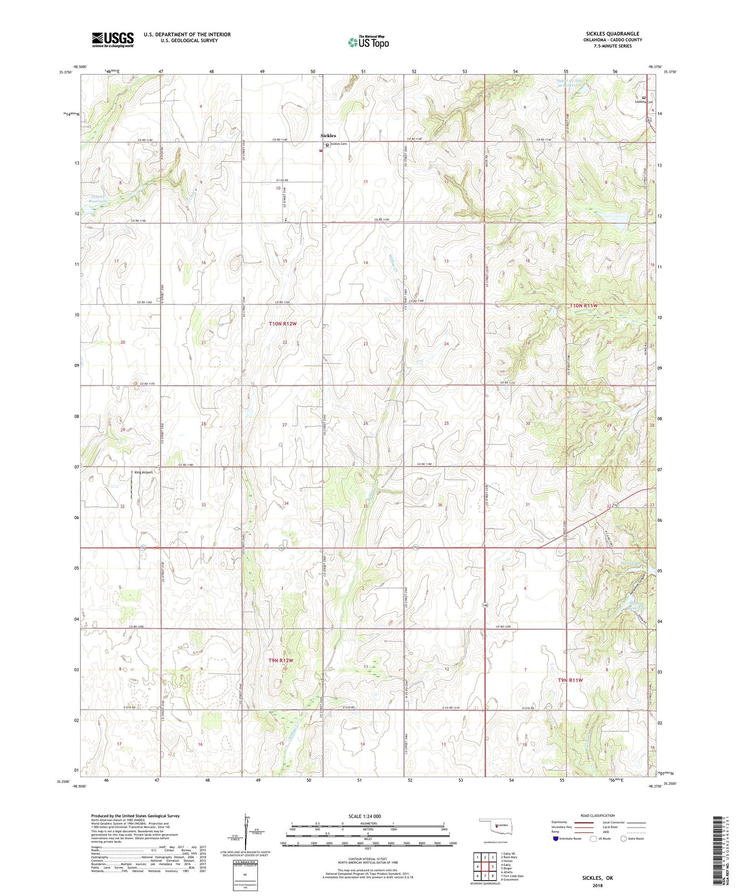
2018 topographic map quadrangle Sickles in the state of Oklahoma. Scale: 1:24000. Based on the newly updated USGS 7.5' US Topo map series, this map is in the following counties: Caddo. The map contains contour data, water features, and other items you are used to seeing on USGS maps, but also has updated roads and other features. This is the next generation of topographic maps. Printed on high-quality waterproof paper with UV fade-resistant inks.
Quads adjacent to this one:
West: Eakly
Northwest: Eakly NE
North: Rock Mary
Northeast: Hinton
East: Binger
Southeast: Gracemont
South: Fort Cobb Dam
Southwest: Alfalfa
Contains the following named places: Camp Red Rock, Hunt Lake, King Airport, Kiwanis Youth Camp, Lookeba - Sickles High School, Lookeba Cemetery, Oknoname 015006 Dam, Oknoname 015006 Reservoir, Oknoname 015012 Dam, Oknoname 015012 Reservoir, Oknoname 015013 Reservoir, Oknoname 051013 Dam, Sickles, Sickles Cemetery, Sickles Volunteer Fire Association, Sugar Creek Site 10 Dam, Sugar Creek Site 10 Reservoir, Sugar Creek Site 39 Dam, Sugar Creek Site 39 Reservoir, Three-Way Corner, Township of Sickles, ZIP Code: 73053