MyTopo
Alfalfa Oklahoma US Topo Map
Couldn't load pickup availability
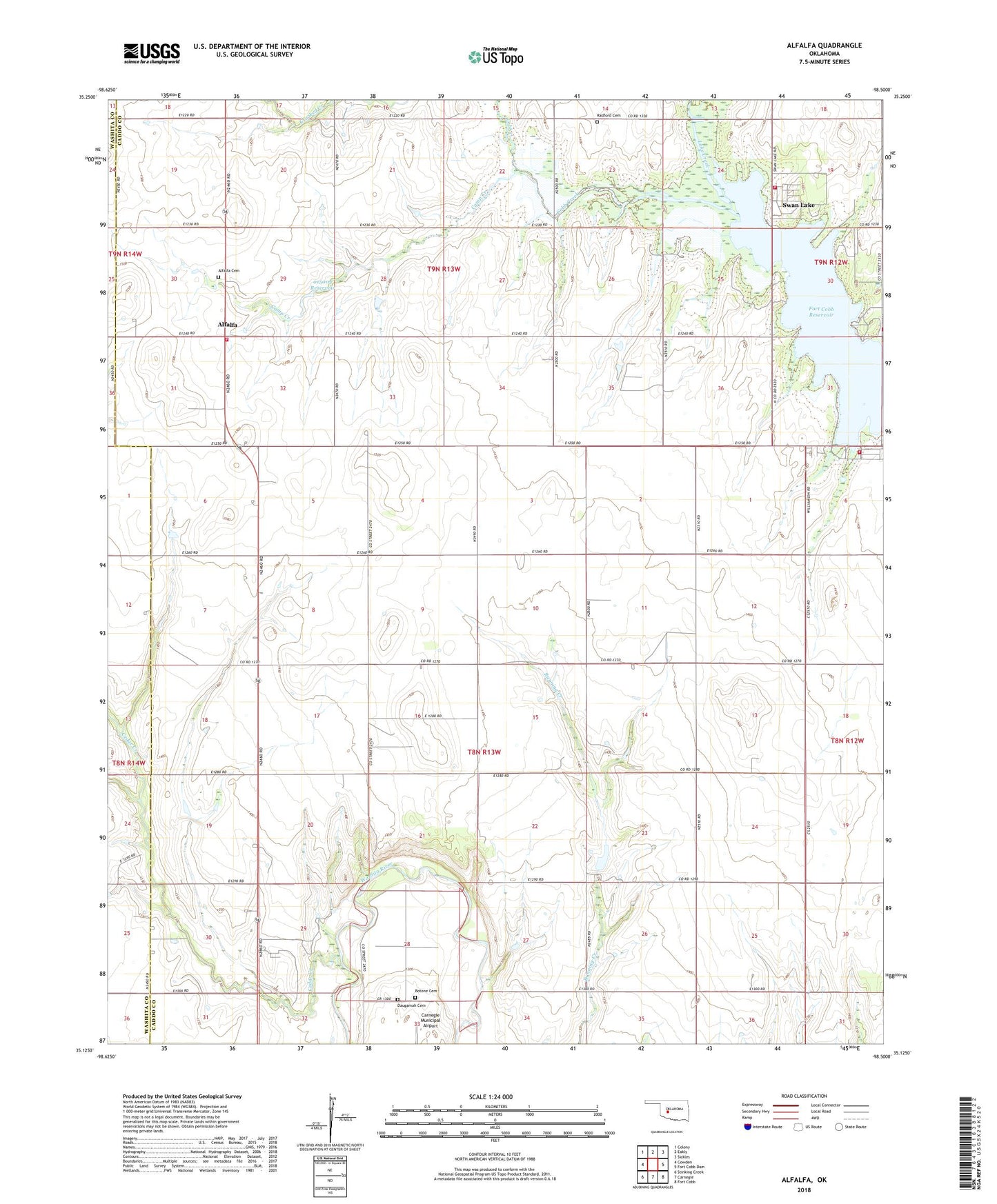
2022 topographic map quadrangle Alfalfa in the state of Oklahoma. Scale: 1:24000. Based on the newly updated USGS 7.5' US Topo map series, this map is in the following counties: Caddo, Washita. The map contains contour data, water features, and other items you are used to seeing on USGS maps, but also has updated roads and other features. This is the next generation of topographic maps. Printed on high-quality waterproof paper with UV fade-resistant inks.
Quads adjacent to this one:
West: Cowden
Northwest: Colony
North: Eakly
Northeast: Sickles
East: Fort Cobb Dam
Southeast: Fort Cobb
South: Carnegie
Southwest: Stinking Creek
This map covers the same area as the classic USGS quad with code o35098b5.
Contains the following named places: Alfalfa, Alfalfa Cemetery, Alfalfa Rural Volunteer Fire Department, Alfalfa School, Botone Cemetery, Camp Creek, Cedar Creek, Cowden Laterals Site 10 Dam, Cowden Laterals Site 10 Reservoir, Cowden Laterals Site 101 Dam, Cowden Laterals Site 101 Reservoir, Cowden Laterals Site 9 Dam, Cowden Laterals Site 9 Reservoir, Daugamah Cemetery, Fly Inn Number 2 Fire Department, Fort Cobb State Wildlife Management Area, Lake Creek, Oknoname 015004 Dam, Oknoname 015004 Reservoir, Pleasant View Church, Radford Cemetery, Swan Lake, Swan Lake Volunteer Firefighters, Township of North Lathram, Township of Swan Lake