MyTopo
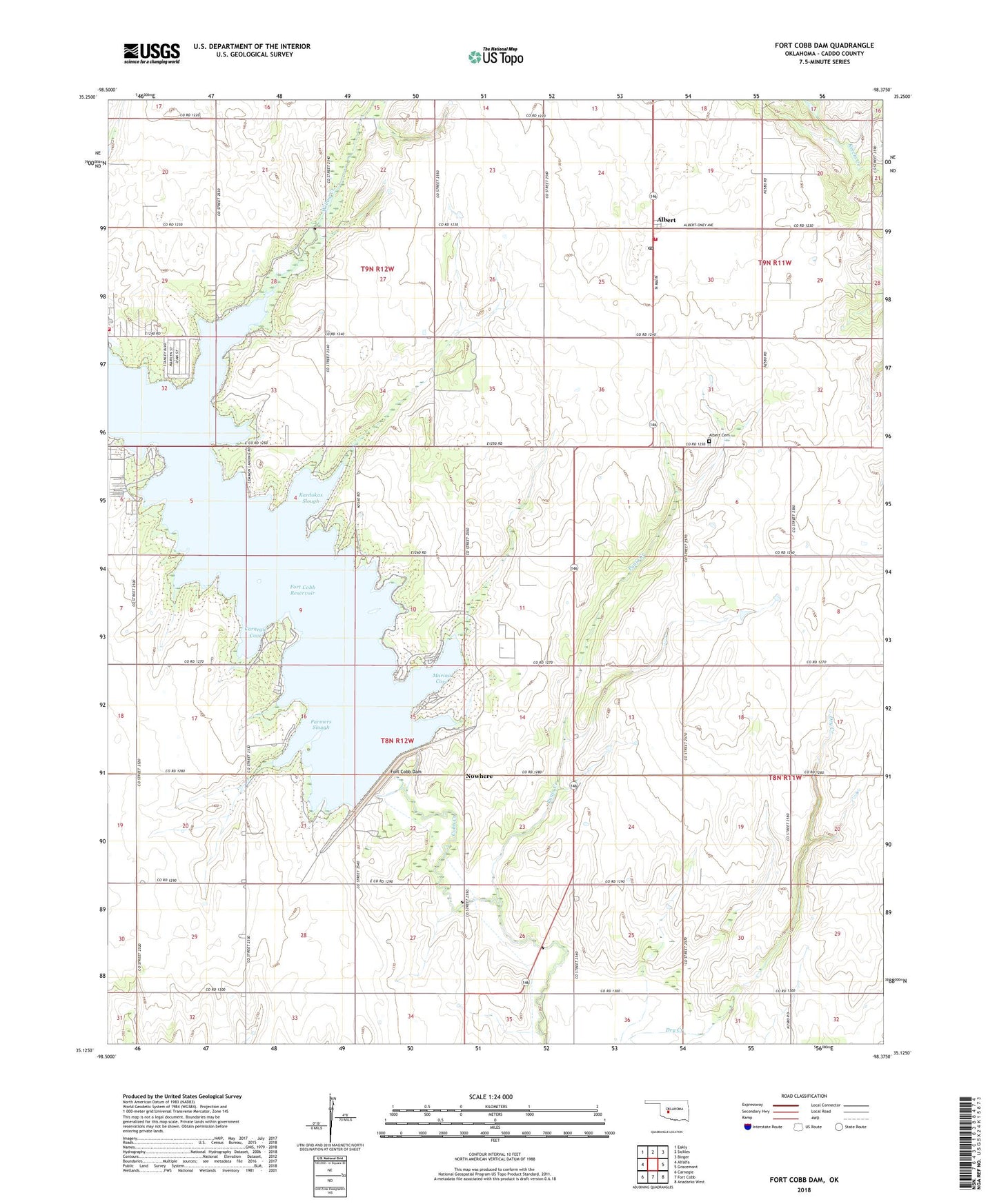
Fort Cobb Dam Oklahoma US Topo Map
Couldn't load pickup availability
2022 topographic map quadrangle Fort Cobb Dam in the state of Oklahoma. Scale: 1:24000. Based on the newly updated USGS 7.5' US Topo map series, this map is in the following counties: Caddo. The map contains contour data, water features, and other items you are used to seeing on USGS maps, but also has updated roads and other features. This is the next generation of topographic maps. Printed on high-quality waterproof paper with UV fade-resistant inks.
Quads adjacent to this one:
West: Alfalfa
Northwest: Eakly
North: Sickles
Northeast: Binger
East: Gracemont
Southeast: Anadarko West
South: Fort Cobb
Southwest: Carnegie
This map covers the same area as the classic USGS quad with code o35098b4.
Contains the following named places: Albert, Albert Cemetery, Albert Post Office, Caddo County, Carnegie Cove, Crow Roost Rural Volunteer Fire Department, Farmers Slough, Fort Cobb Dam, Fort Cobb Reservoir, Fort Cobb State Park, Fort Cobb State Public Hunting Area, Highland Church, Kardokas Slough, Marina Cove, Nowhere, Oknaname 015018 Reservoir, Oknoname 015018 Dam, Oney School, Punjo Creek, Township of North Cobb, Township of Willow, Twin City Fire Department, Willow Creek