MyTopo
Stonewall Oklahoma US Topo Map
Couldn't load pickup availability
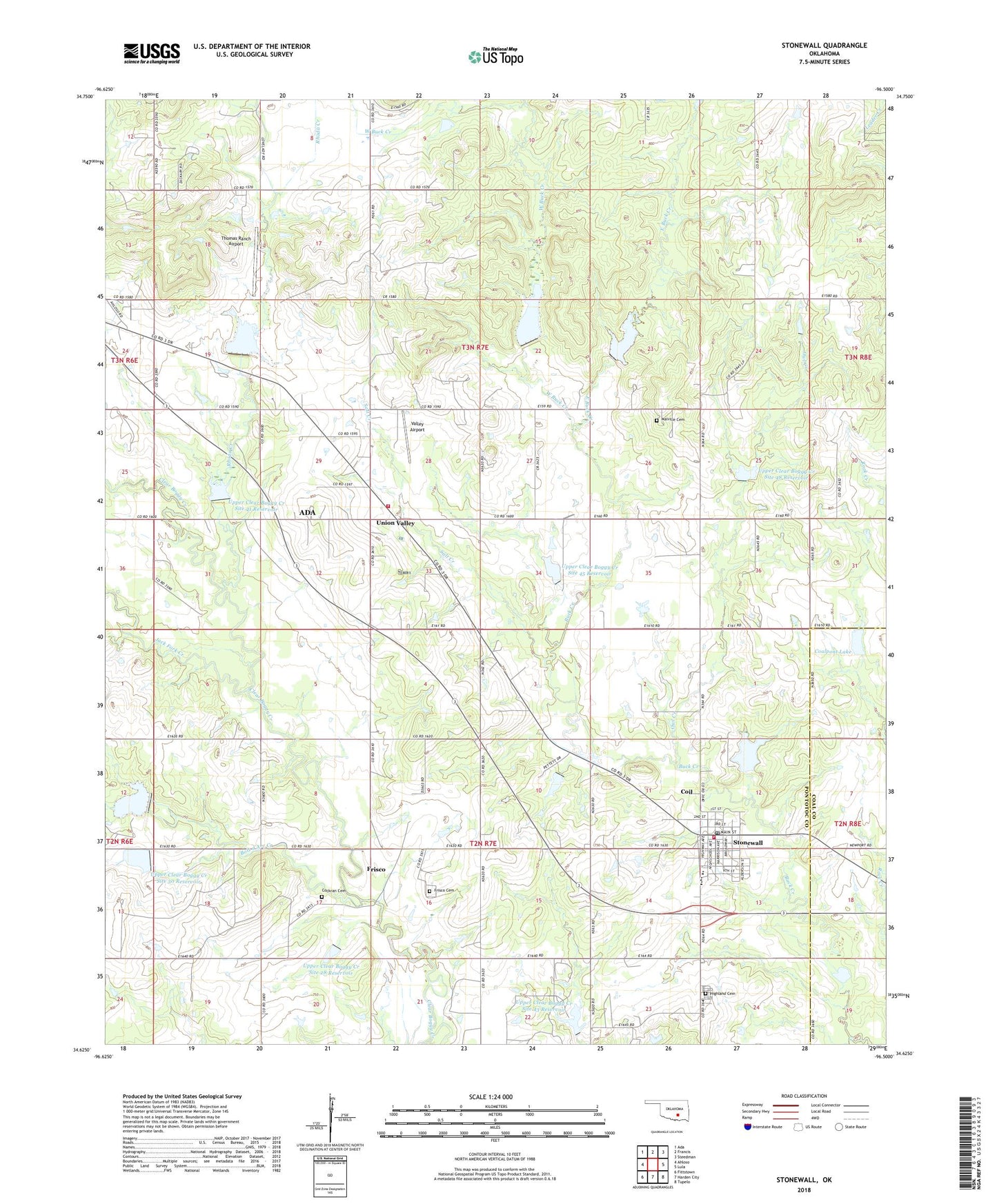
2022 topographic map quadrangle Stonewall in the state of Oklahoma. Scale: 1:24000. Based on the newly updated USGS 7.5' US Topo map series, this map is in the following counties: Pontotoc, Coal. The map contains contour data, water features, and other items you are used to seeing on USGS maps, but also has updated roads and other features. This is the next generation of topographic maps. Printed on high-quality waterproof paper with UV fade-resistant inks.
Quads adjacent to this one:
West: Ahloso
Northwest: Ada
North: Francis
Northeast: Steedman
East: Lula
Southeast: Tupelo
South: Harden City
Southwest: Fittstown
This map covers the same area as the classic USGS quad with code o34096f5.
Contains the following named places: Ahloso School, Bois d'Arc Creek, City Marshall, Coalpont Lake, Coalpont Lake Dam, Cockran Cemetery, Coil, East Buck Creek, First Baptist Church, Frisco, Frisco Cemetery, Highland Cemetery, Jack Fork Creek, Malville Cemetery, McLish Middle School, North Fitts Oil Field, Owl Creek, Owl Creek Church, Rhoda Creek, Salt Creek, Southeast Pontotoc Division, Stonewall, Stonewall Dam, Stonewall Elementary School, Stonewall Fire Department, Stonewall High School, Stonewall Lake, Stonewall Post Office, Thomas Ranch Airport, Town of Stonewall, Union Valley, Union Valley Volunteer Fire Department, Upper Clear Boggy Creek Site 28 Dam, Upper Clear Boggy Creek Site 28 Reservoir, Upper Clear Boggy Creek Site 30 Dam, Upper Clear Boggy Creek Site 30 Reservoir, Upper Clear Boggy Creek Site 31 Dam, Upper Clear Boggy Creek Site 31 Reservoir, Upper Clear Boggy Creek Site 41 Dam, Upper Clear Boggy Creek Site 41 Reservoir, Upper Clear Boggy Creek Site 42 Dam, Upper Clear Boggy Creek Site 42 Reservoir, Upper Clear Boggy Creek Site 43 Dam, Upper Clear Boggy Creek Site 43 Reservoir, Upper Clear Boggy Creek Site 45 Dam, Upper Clear Boggy Creek Site 45 Reservoir, Upper Clear Boggy Creek Site 46 Dam, Upper Clear Boggy Creek Site 46 Reservoir, Upper Clear Boggy Creek Site 47 Dam, Upper Clear Boggy Creek Site 47 Reservoir, Upper Clear Boggy Creek Site 48 Dam, Upper Clear Boggy Creek Site 48 Reservoir, Valley Airport, West Buck Creek, ZIP Code: 74842