MyTopo
Strang Oklahoma US Topo Map
Couldn't load pickup availability
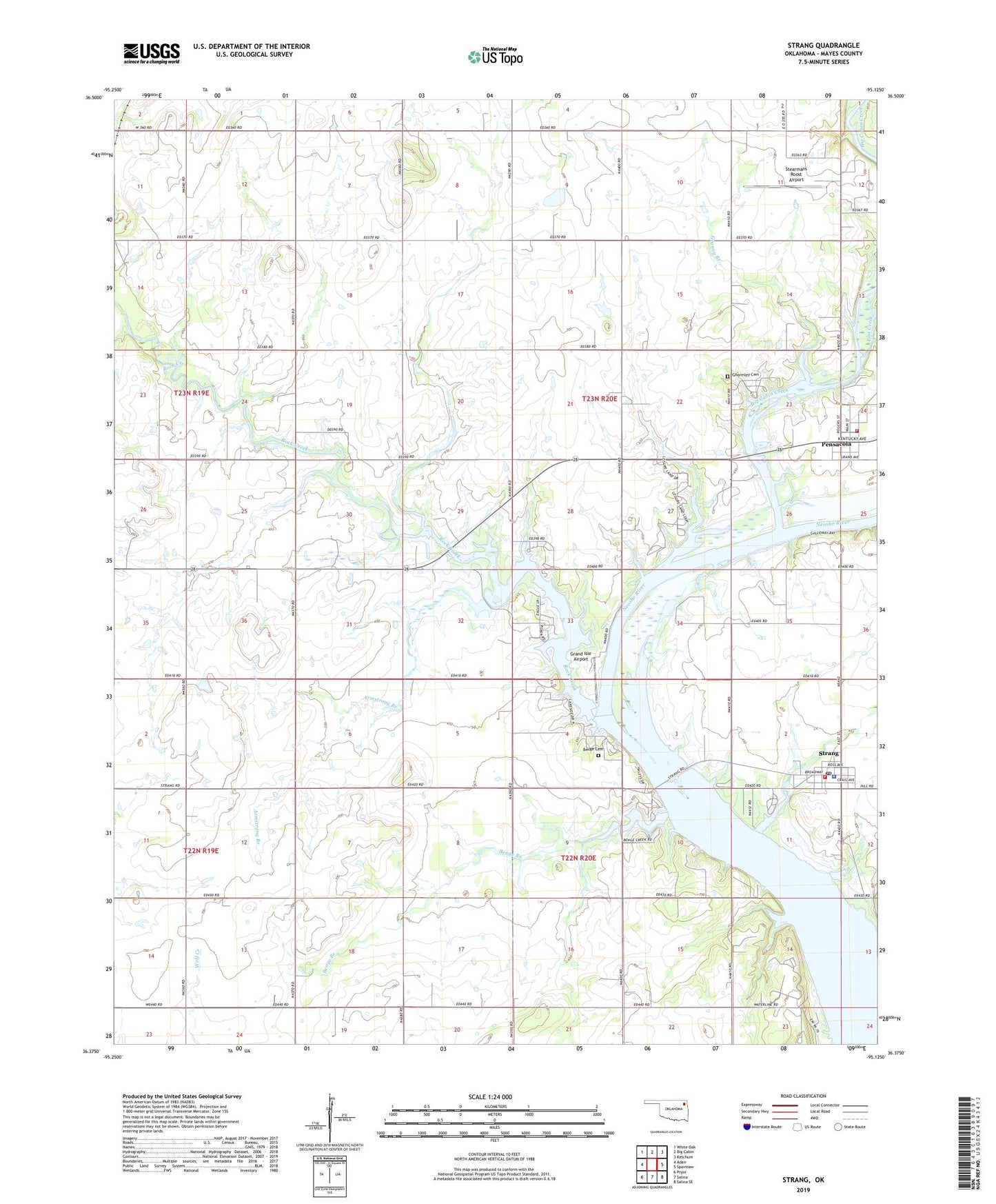
2019 topographic map quadrangle Strang in the state of Oklahoma. Scale: 1:24000. Based on the newly updated USGS 7.5' US Topo map series, this map is in the following counties: Mayes. The map contains contour data, water features, and other items you are used to seeing on USGS maps, but also has updated roads and other features. This is the next generation of topographic maps. Printed on high-quality waterproof paper with UV fade-resistant inks.
Quads adjacent to this one:
West: Adair
Northwest: White Oak
North: Big Cabin
Northeast: Ketchum
East: Spavinaw
Southeast: Salina SE
South: Salina
Southwest: Pryor
Contains the following named places: Armstrong Branch, Benge Branch, Benge Cemetery, Big Cabin Creek, Cabin Creek Fire Department, City of Adair Waterworks, Elm Creek, Ghormley Cemetery, Grand Isle Airport, Granny Branch, Greenbriar Church, Pensacola, Rock Creek, Rock Creek Church, Stearmans Roost Airport, Strang, Strang Community Fire Department, Strang Police Department, Strang Post Office, Town of Pensacola, Town of Strang, Township of Adair, Utopia Church