MyTopo
Tom Oklahoma US Topo Map
Couldn't load pickup availability
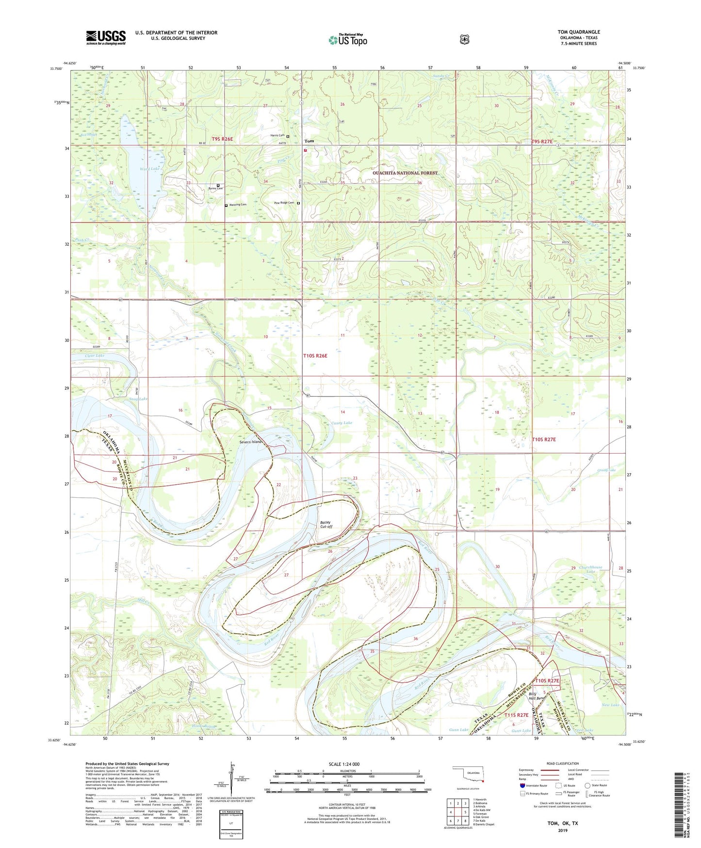
2019 topographic map quadrangle Tom in the states of Oklahoma, Texas. Scale: 1:24000. Based on the newly updated USGS 7.5' US Topo map series, this map is in the following counties: McCurtain, Bowie. The map contains contour data, water features, and other items you are used to seeing on USGS maps, but also has updated roads and other features. This is the next generation of topographic maps. Printed on high-quality waterproof paper with UV fade-resistant inks.
Quads adjacent to this one:
West: De Kalb NW
Northwest: Haworth
North: Bokhoma
Northeast: Arkinda
East: Foreman
Southeast: Daniels Chapel
South: De Kalb
Southwest: Oak Grove
Contains the following named places: Bailey Cut-off, Bethel Church, Breedlove Lake, Bright Star Church, Byrms Cemetery, Caney Lake, Churchhouse Lake, Clear Lake, Grassy Lake, Harris Cemetery, Manning Cemetery, Mill Creek, Norwood Creek, Oak Ridge School, Pecan Grove School, Pine Creek, Pine Ridge Cemetery, Pine Ridge School, Pleasant Grove School, Push Creek, Sand Hill School, Seven Island, Severn Island, Snag Lake, Tom, Tom Lookout, Tom Volunteer Fire Department, Ward Lake, Young Lake