MyTopo
De Kalb Texas US Topo Map
Couldn't load pickup availability
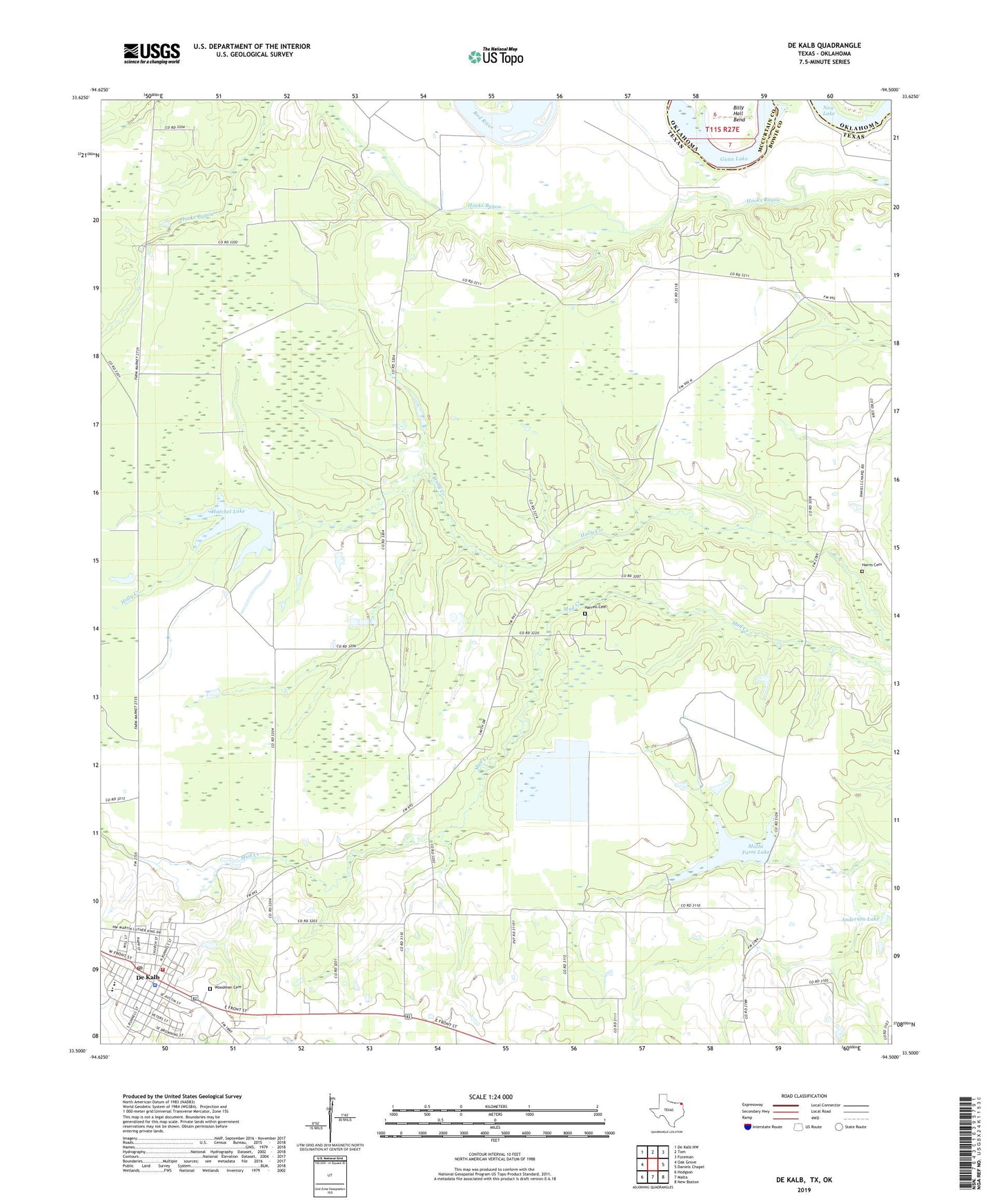
2022 topographic map quadrangle De Kalb in the states of Texas, Oklahoma. Scale: 1:24000. Based on the newly updated USGS 7.5' US Topo map series, this map is in the following counties: Bowie, McCurtain. The map contains contour data, water features, and other items you are used to seeing on USGS maps, but also has updated roads and other features. This is the next generation of topographic maps. Printed on high-quality waterproof paper with UV fade-resistant inks.
Quads adjacent to this one:
West: Oak Grove
Northwest: De Kalb NW
North: Tom
Northeast: Foreman
East: Daniels Chapel
Southeast: New Boston
South: Malta
Southwest: Hodgson
This map covers the same area as the classic USGS quad with code o33094e5.
Contains the following named places: Anderson Lake, Anderson Lake Dam, Bethlehem School, Billy Hall Bend, Blackman Dam Number 1, Blackman Dam Number 2, Blackman Lake Number 1, Blackman Lake Number 2, City of De Kalb, De Kalb, De Kalb Police Department, De Kalb Post Office, Dekalb Elementary School, Dekalb Fire Department, Dekalb High School, Dekalb Middle School, Eldorado Church, First Baptist Church, Gunn Lake, Harrell Cemetery, Harris Cemetery, Hatchel Lake, Liberty Hill School, Malta Farm Lake, Mount Zion Church, New Lake, United Church of God in Christ, Woodman Cemetery