MyTopo
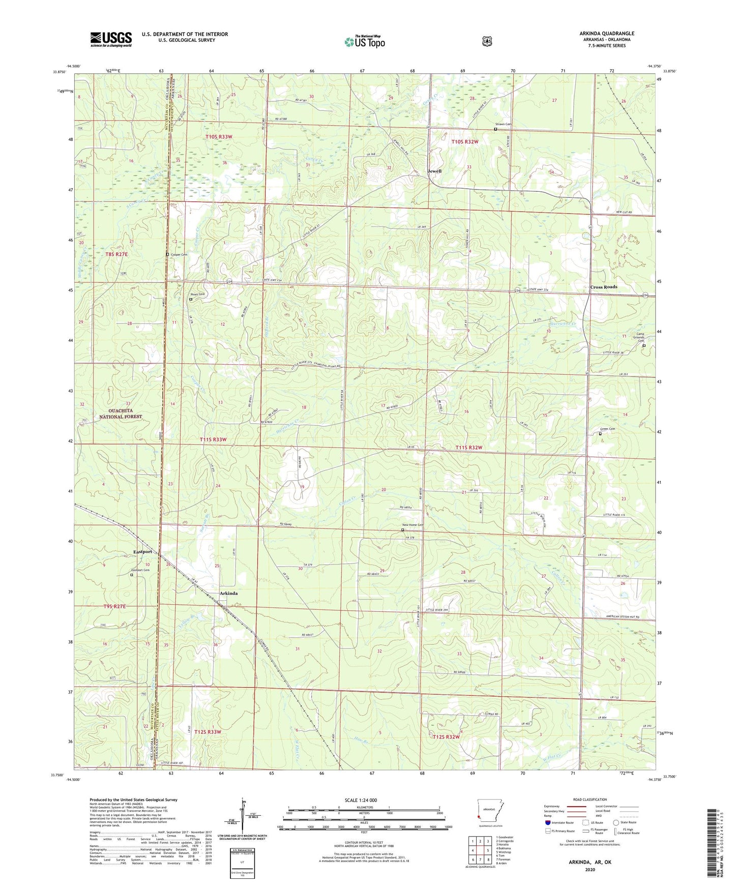
Arkinda Arkansas US Topo Map
Couldn't load pickup availability
2024 topographic map quadrangle Arkinda in the states of Arkansas, Oklahoma. Scale: 1:24000. Based on the newly updated USGS 7.5' US Topo map series, this map is in the following counties: Little River, McCurtain. The map contains contour data, water features, and other items you are used to seeing on USGS maps, but also has updated roads and other features. This is the next generation of topographic maps. Printed on high-quality waterproof paper with UV fade-resistant inks.
Quads adjacent to this one:
West: Bokhoma
Northwest: Goodwater
North: Cerrogordo
Northeast: Horatio
East: Winthrop
Southeast: Arden
South: Foreman
Southwest: Tom
Contains the following named places: Arkinda, Campground Cemetery, Climax School, Cooper Cemetery, Cooper Creek, Cross Roads, Eastport, Eastport Cemetery, Gafford Branch, Green Cemetery, Jewell, King Rider School, King Ryder Church of Christ, Middle Caney Creek, Miller School, New Home Cemetery, North Caney Creek, Oak Grove, Oak Grove School, Piney Cemetery, South Caney Creek, Strawn Cemetery, Township of Arkinda, Township of Jeff Davis, Township of Jewell, White Oak Creek