MyTopo
Wakita SW Oklahoma US Topo Map
Couldn't load pickup availability
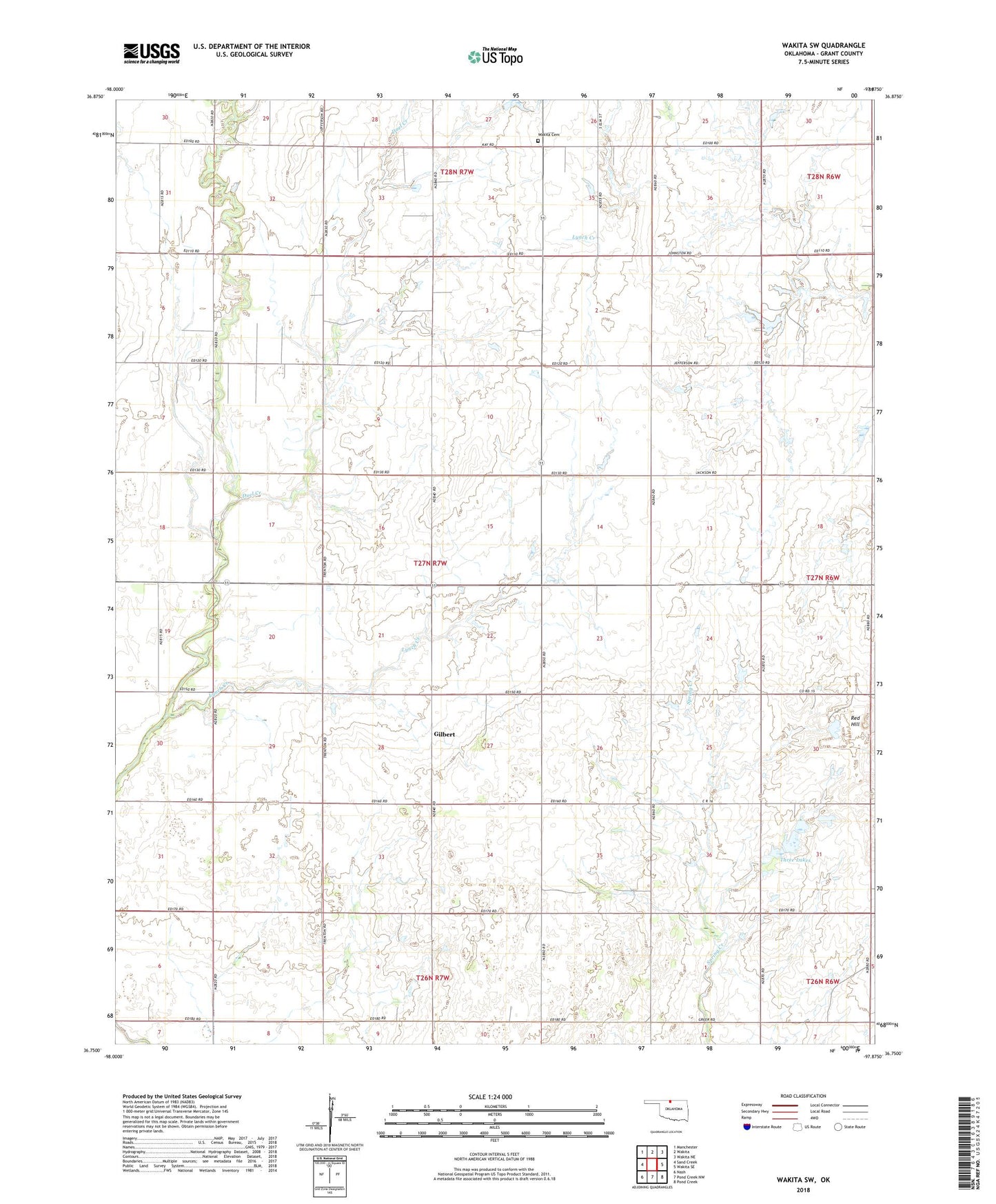
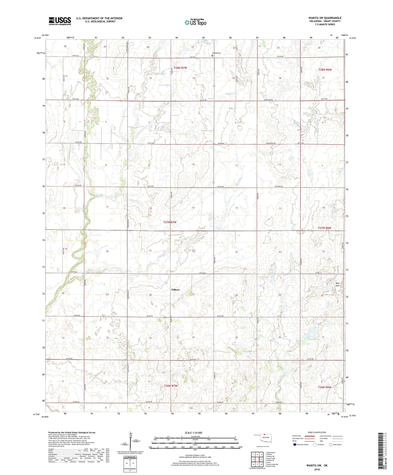
2018 topographic map quadrangle Wakita SW in the state of Oklahoma. Scale: 1:24000. Based on the newly updated USGS 7.5' US Topo map series, this map is in the following counties: Grant. The map contains contour data, water features, and other items you are used to seeing on USGS maps, but also has updated roads and other features. This is the next generation of topographic maps. Printed on high-quality waterproof paper with UV fade-resistant inks.
Quads adjacent to this one:
West: Sand Creek
Northwest: Manchester
North: Wakita
Northeast: Wakita NE
East: Wakita SE
Southeast: Pond Creek
South: Pond Creek NW
Southwest: Nash
Contains the following named places: Cherokita Trend Oil and Gas Field, Cherry Vale Oil and Gas Field, Duel Creek, Gilbert, Gore School, Lynch Creek, Prairie Queen Church, Red Hill, Three Lakes, Township of Gore, Wakita Cemetery, Weedpatch International Airport