MyTopo
Pond Creek Oklahoma US Topo Map
Couldn't load pickup availability
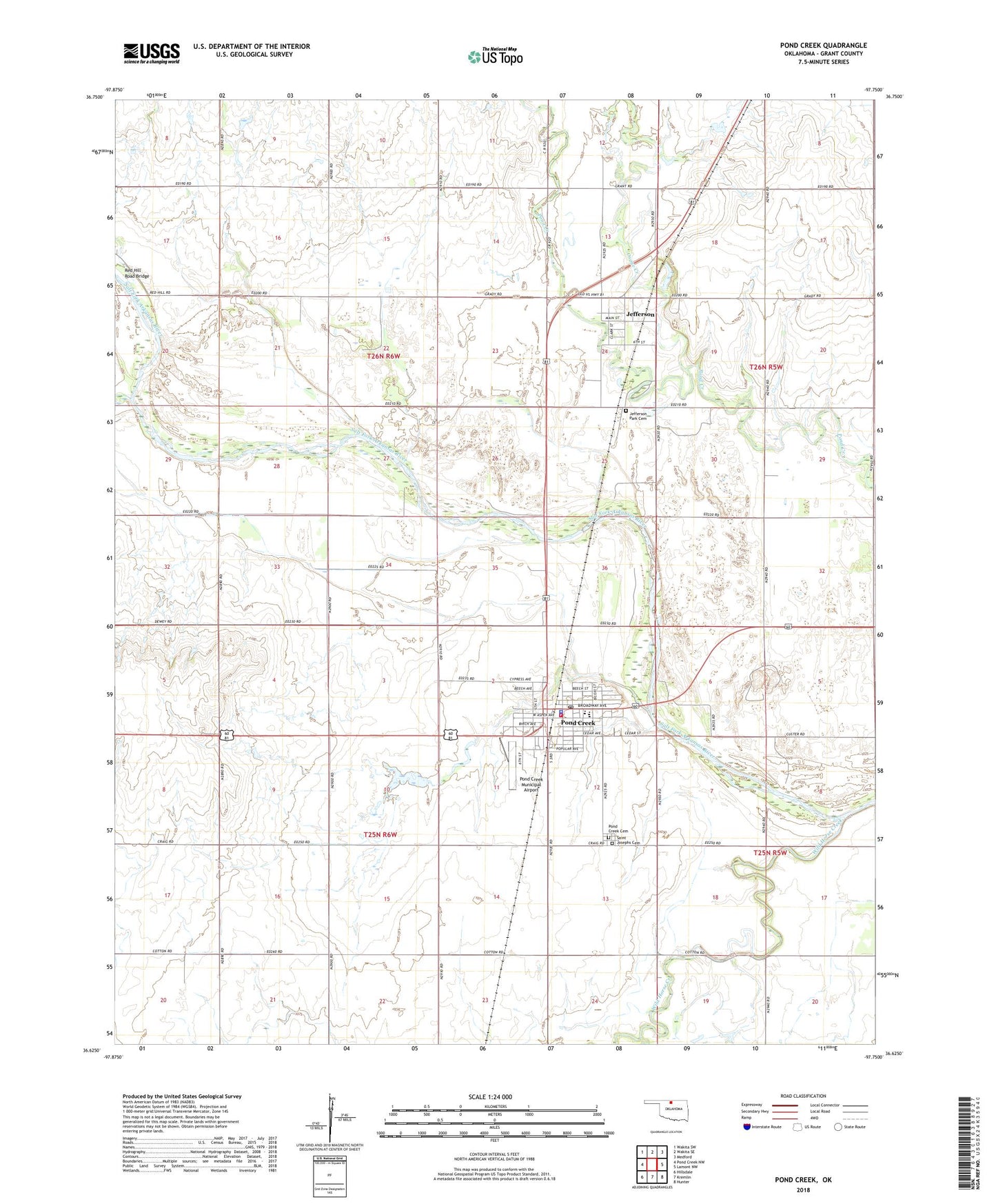
2022 topographic map quadrangle Pond Creek in the state of Oklahoma. Scale: 1:24000. Based on the newly updated USGS 7.5' US Topo map series, this map is in the following counties: Grant. The map contains contour data, water features, and other items you are used to seeing on USGS maps, but also has updated roads and other features. This is the next generation of topographic maps. Printed on high-quality waterproof paper with UV fade-resistant inks.
Quads adjacent to this one:
West: Pond Creek NW
Northwest: Wakita SW
North: Wakita SE
Northeast: Medford
East: Lamont NW
Southeast: Hunter
South: Kremlin
Southwest: Hillsdale
This map covers the same area as the classic USGS quad with code o36097f7.
Contains the following named places: City of Pond Creek, East Grant-Pond Creek Oil Field, Jefferson, Jefferson Park Cemetery, Krittenbrink Landing Strip, Osage Creek, Pond Creek, Pond Creek - Hunter Elementary School, Pond Creek - Hunter High School, Pond Creek Cemetery, Pond Creek Fire Department and EMS, Pond Creek Municipal Airport, Pond Creek Police Department, Pond Creek Post Office, Red Hill Road Bridge, Rock Island Park, Saint Josephs Cemetery, Town of Jefferson, Township of Berry, Township of Rock Island, Wild Horse Creek, ZIP Code: 73766