MyTopo
Wakita SE Oklahoma US Topo Map
Couldn't load pickup availability
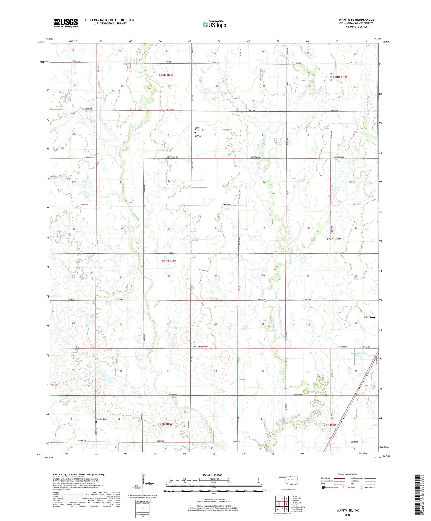
2022 topographic map quadrangle Wakita SE in the state of Oklahoma. Scale: 1:24000. Based on the newly updated USGS 7.5' US Topo map series, this map is in the following counties: Grant. The map contains contour data, water features, and other items you are used to seeing on USGS maps, but also has updated roads and other features. This is the next generation of topographic maps. Printed on high-quality waterproof paper with UV fade-resistant inks.
Quads adjacent to this one:
West: Wakita SW
Northwest: Wakita
North: Wakita NE
Northeast: Renfrow
East: Medford
Southeast: Lamont NW
South: Pond Creek
Southwest: Pond Creek NW
This map covers the same area as the classic USGS quad with code o36097g7.
Contains the following named places: Clyde, Fairview Cemetery, Grant County, Klondike Cemetery, Koch Holding Pond A, Koch Holding Pond A Dam, Saint Anthony Cemetery, Township of Valley