MyTopo
Welty Oklahoma US Topo Map
Couldn't load pickup availability
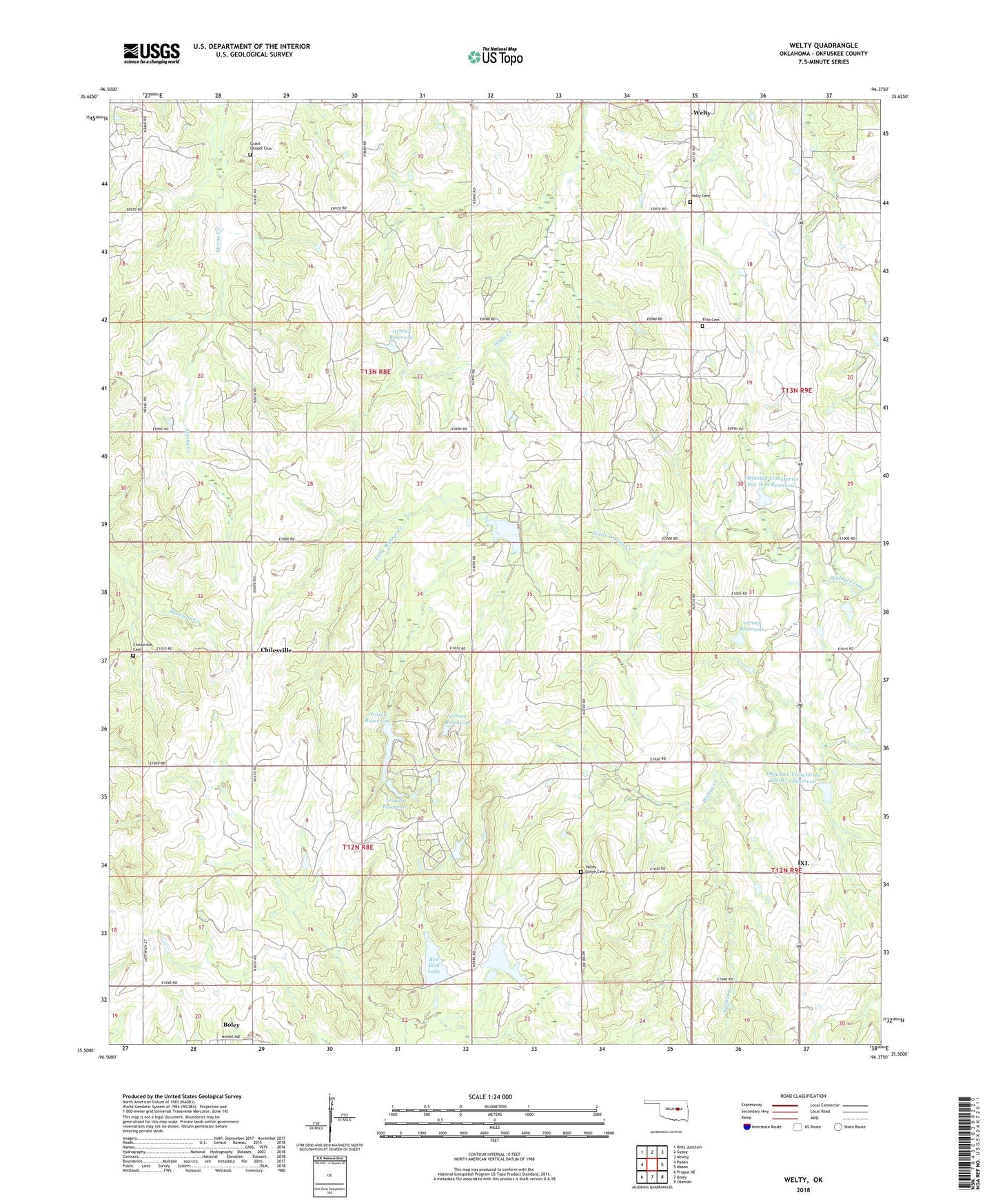
2018 topographic map quadrangle Welty in the state of Oklahoma. Scale: 1:24000. Based on the newly updated USGS 7.5' US Topo map series, this map is in the following counties: Okfuskee. The map contains contour data, water features, and other items you are used to seeing on USGS maps, but also has updated roads and other features. This is the next generation of topographic maps. Printed on high-quality waterproof paper with UV fade-resistant inks.
Quads adjacent to this one:
West: Paden
Northwest: Ritts Junction
North: Gypsy
Northeast: Newby
East: Mason
Southeast: Okemah
South: Boley
Southwest: Prague NE
Contains the following named places: AME Church, Boley Division, Chilesville, Chilesville Cemetery, Claytons Chapel, Fine Cemetery, Grant Chapel, Grant Chapel Cemetery, Highway Mission Church, IXL, Ixl Volunteer Fire Department, Little Walnut Creek, New Hope Church, Okfuskee Tributaries Site W-5 Dam, Okfuskee Tributaries Site W-5 Reservoir, Okfuskee Tributaries Site W-7 Dam, Okfuskee Tributaries Site W-7 Reservoir, Okfuskee Tributaries Site W-8 Dam, Okfuskee Tributaries Site W-8 Reservoir, Oknoname 107018 Dam, Oknoname 107018 Reservoir, Oknoname 107019 Dam, Oknoname 107019 Reservoir, Oknoname 107020 Dam, Oknoname 107020 Reservoir, Oknoname 107021 Dam, Oknoname 107021 Reservoir, Oknoname 107022 Dam, Oknoname 107022 Reservoir, Oknoname 107023 Dam, Oknoname 107023 Reservoir, Oknoname 107024 Dam, Oknoname 107024 Reservoir, Oknoname 107025 Dam, Oknoname 107025 Reservoir, Pilgrim Rest Church, Pleasant Hill Church, Red Bird Lake, Red Bird Lake Dam, Town of IXL, Valley Grove Cemetery, Welty, Welty Cemetery, ZIP Codes: 74829, 74833