MyTopo
Wyandotte Oklahoma US Topo Map
Couldn't load pickup availability
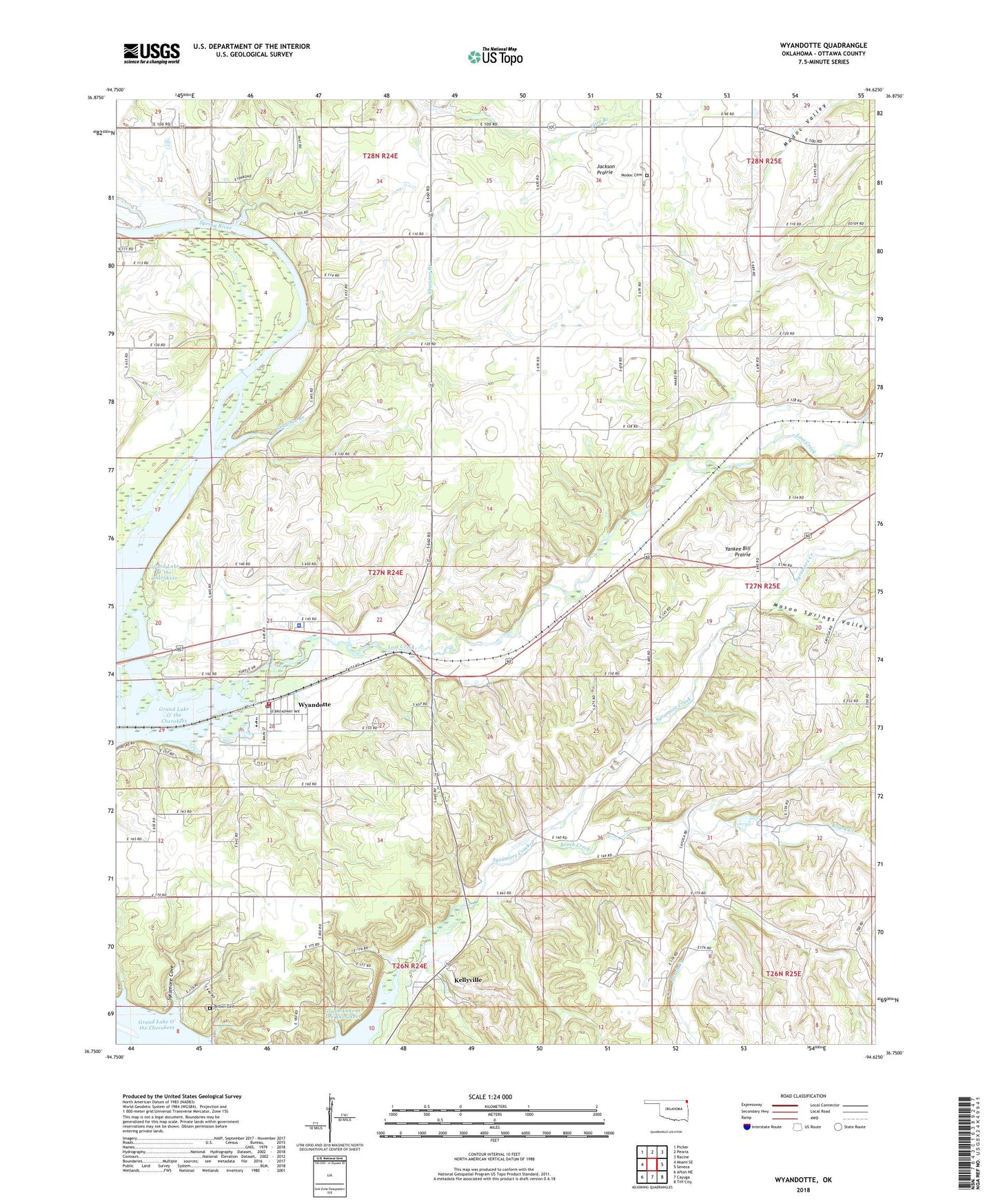
2018 topographic map quadrangle Wyandotte in the state of Oklahoma. Scale: 1:24000. Based on the newly updated USGS 7.5' US Topo map series, this map is in the following counties: Ottawa. The map contains contour data, water features, and other items you are used to seeing on USGS maps, but also has updated roads and other features. This is the next generation of topographic maps. Printed on high-quality waterproof paper with UV fade-resistant inks.
Quads adjacent to this one:
West: Miami SE
Northwest: Picher
North: Peoria
Northeast: Racine
East: Seneca
Southeast: Tiff City
South: Cayuga
Southwest: Afton NE
Contains the following named places: Brown Cemetery, Brush Creek, Cedar Creek, Eastern Shawnee Oklahoma Tribal Statistical Area, Eastside, Jackson Prairie, Kellyville, Lost Creek, Mason Springs Valley, Modoc Cemetery, Modoc Church, Modoc Oklahoma Tribal Statistical Area, Modoc Valley, Owsley School, Pleasant Point School, Roark Creek, Seneca Indian School, Shawnee Branch, South Eight School, Stony Point School, Sycamore Chapel, Sycamore Cove, Sycamore Creek, Town of Wyandotte, Township of Wyandotte, Wayside Church, Wyandotte, Wyandotte Division, Wyandotte Elementary School, Wyandotte Fire Department, Wyandotte High School, Wyandotte Indian Cemetery, Wyandotte Middle School, Wyandotte Oklahoma Tribal Statistical Area, Wyandotte Post Office, Wyandotte Tribal and Municipal Police Department, Yankee Bill Prairie