MyTopo
Afton NE Oklahoma US Topo Map
Couldn't load pickup availability
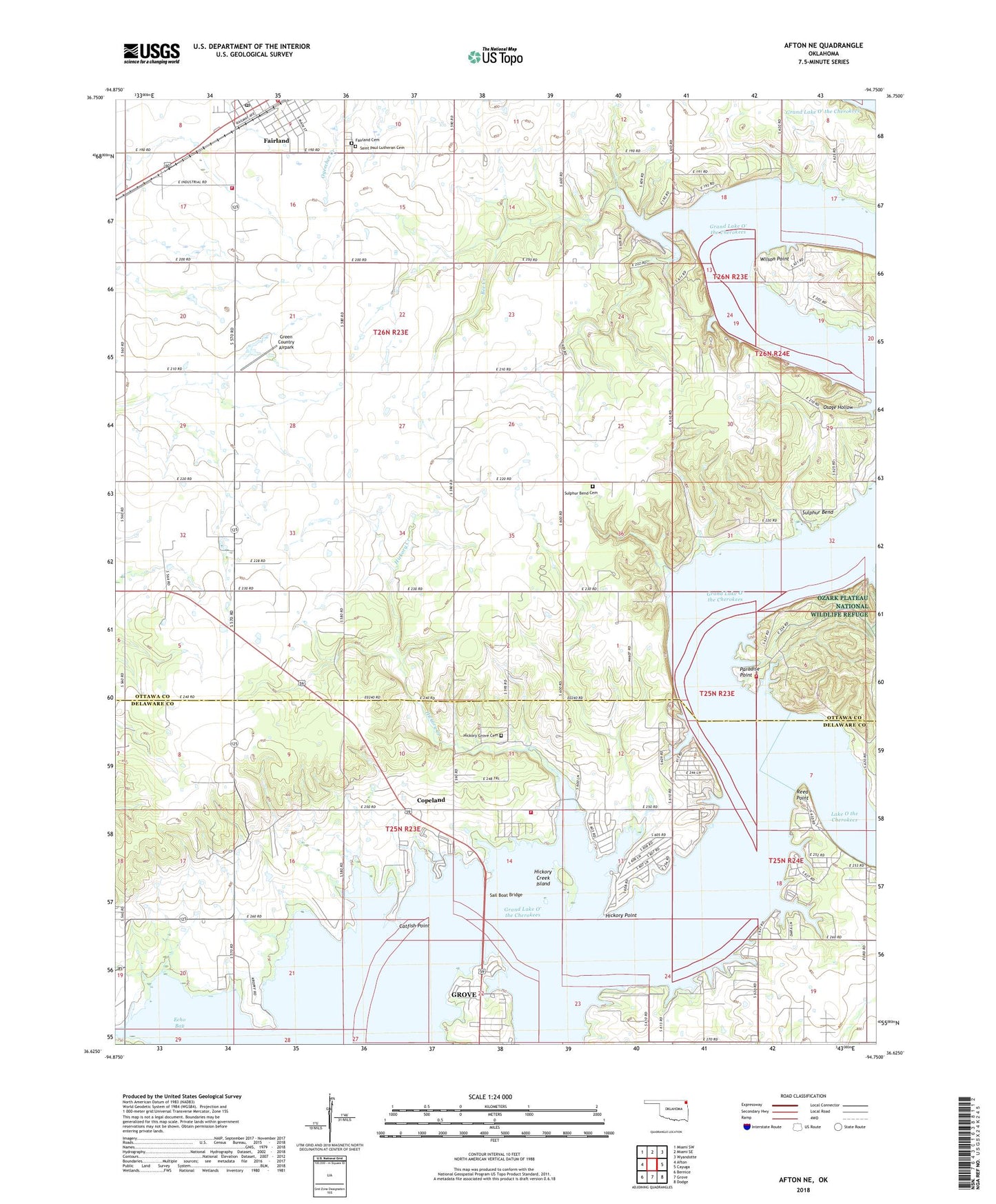
2022 topographic map quadrangle Afton NE in the state of Oklahoma. Scale: 1:24000. Based on the newly updated USGS 7.5' US Topo map series, this map is in the following counties: Ottawa, Delaware. The map contains contour data, water features, and other items you are used to seeing on USGS maps, but also has updated roads and other features. This is the next generation of topographic maps. Printed on high-quality waterproof paper with UV fade-resistant inks.
Quads adjacent to this one:
West: Afton
Northwest: Miami SW
North: Miami SE
Northeast: Wyandotte
East: Cayuga
Southeast: Dodge
South: Grove
Southwest: Bernice
This map covers the same area as the classic USGS quad with code o36094f7.
Contains the following named places: Afton-Fairland Division, Bee Creek, Catfish Point, Cave Spring, City of Fairland Fire Department Station 1, Copeland, Copeland Census Designated Place, Echo Bay, Elk River, Fairland Cemetery, Fairland Post Office, Fairland Volunteer Fire Department Station 2, Green Country Airpark, Hickory Creek, Hickory Creek Island, Hickory Grove Cemetery, Hickory Grove Church, Hickory Grove Fire Department, Hickory Point, Midway Church, Osage Hollow, Paradise Point, Paradise Point Fire Station, Reed Point, Sail Boat Bridge, Saint Elizabeth Mission, Saint Paul Lutheran Cemetery, Sulphur Bend, Sulphur Bend Cemetery, Wilson Point, Wolf Creek, ZIP Code: 74343