MyTopo
Bath Canyon Oregon US Topo Map
Couldn't load pickup availability
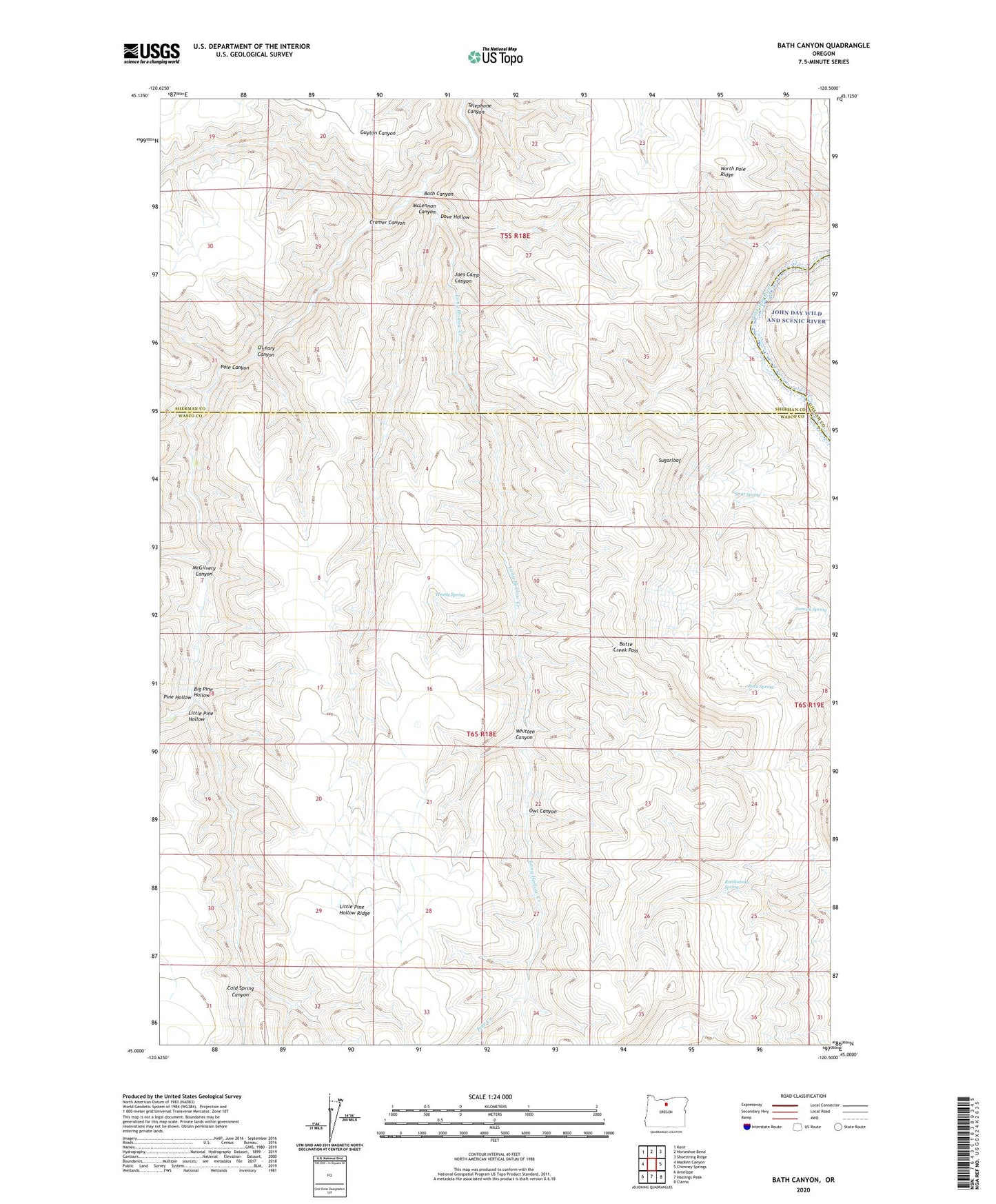
2020 topographic map quadrangle Bath Canyon in the state of Oregon. Scale: 1:24000. Based on the newly updated USGS 7.5' US Topo map series, this map is in the following counties: Wasco, Sherman, Gilliam. The map contains contour data, water features, and other items you are used to seeing on USGS maps, but also has updated roads and other features. This is the next generation of topographic maps. Printed on high-quality waterproof paper with UV fade-resistant inks.
Quads adjacent to this one:
West: Macken Canyon
Northwest: Kent
North: Horseshoe Bend
Northeast: Shoestring Ridge
East: Chimney Springs
Southeast: Clarno
South: Hastings Peak
Southwest: Antelope
Contains the following named places: Bath Canyon, Big Pine Hollow, Butte Creek Pass, Cold Spring Canyon, Cramer Canyon, Dove Hollow, Duncan Spring, Heany Spring, Joes Camp Canyon, Little Pine Hollow, Little Pine Hollow Ridge, Long Hollow Creek, McGilvery Canyon, McLennan Canyon, North Pole Ridge, O'Leary Canyon, Owl Canyon, Pole Canyon, Pole Creek, Rattlesnake Spring, Rock Spring, Scott Spring, Sugarloaf, Telephone Canyon, Whitten Canyon