MyTopo
Macken Canyon Oregon US Topo Map
Couldn't load pickup availability
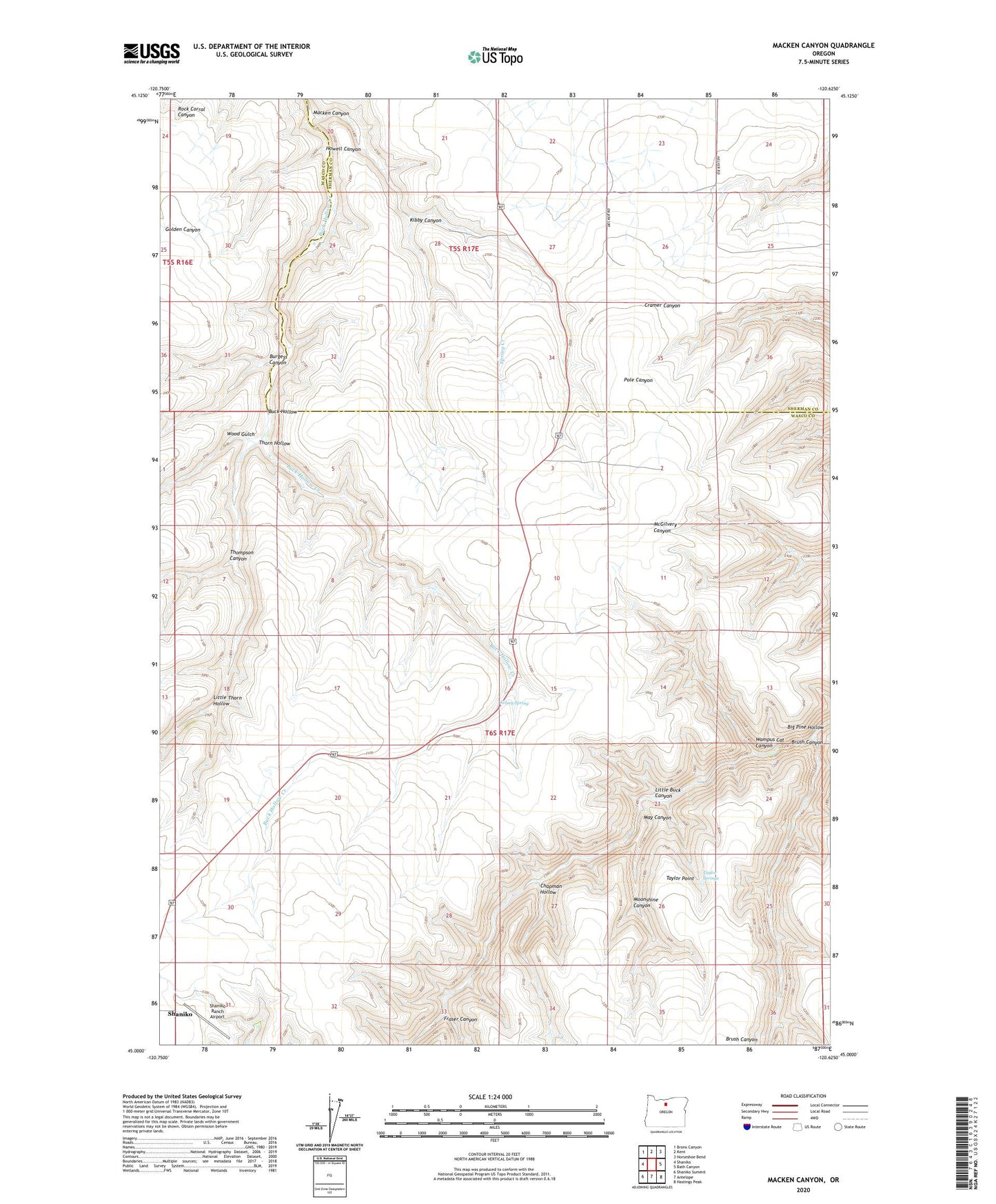
2023 topographic map quadrangle Macken Canyon in the state of Oregon. Scale: 1:24000. Based on the newly updated USGS 7.5' US Topo map series, this map is in the following counties: Wasco, Sherman. The map contains contour data, water features, and other items you are used to seeing on USGS maps, but also has updated roads and other features. This is the next generation of topographic maps. Printed on high-quality waterproof paper with UV fade-resistant inks.
Quads adjacent to this one:
West: Shaniko
Northwest: Bronx Canyon
North: Kent
Northeast: Horseshoe Bend
East: Bath Canyon
Southeast: Hastings Peak
South: Antelope
Southwest: Shaniko Summit
This map covers the same area as the classic USGS quad with code o45120a6.
Contains the following named places: Brush Canyon, Burgess Canyon, Chapman Hollow, Fraser Canyon, Howell Canyon, Kelsey, Kelsey Spring, Kibby Canyon, Little Buck Canyon, Little Thorn Hollow, Macken Canyon, May Canyon, Moonshine Canyon, Shaniko Ranch Airport, Taylor Point, Taylor Springs, Thompson Canyon, Thorn Hollow, Wampus Cat Canyon, Wood Gulch, ZIP Code: 97057